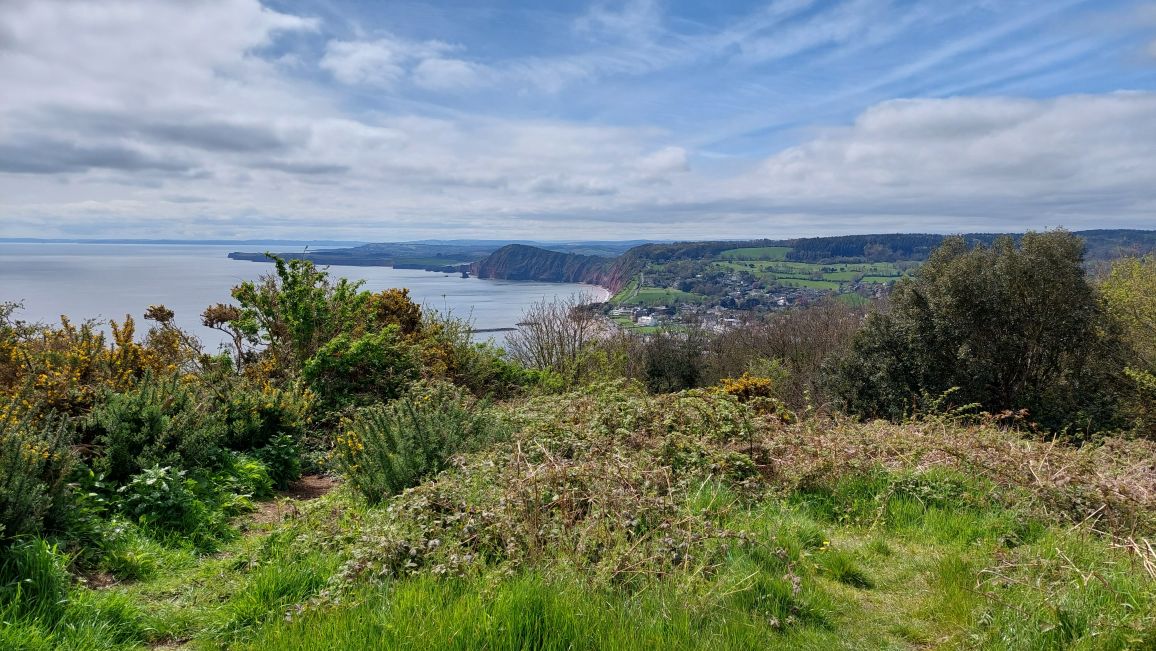
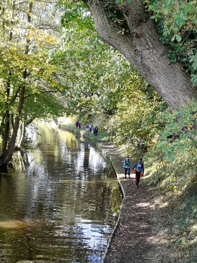
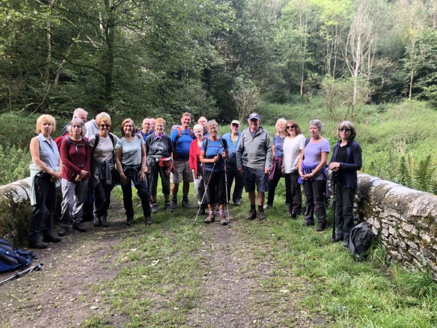
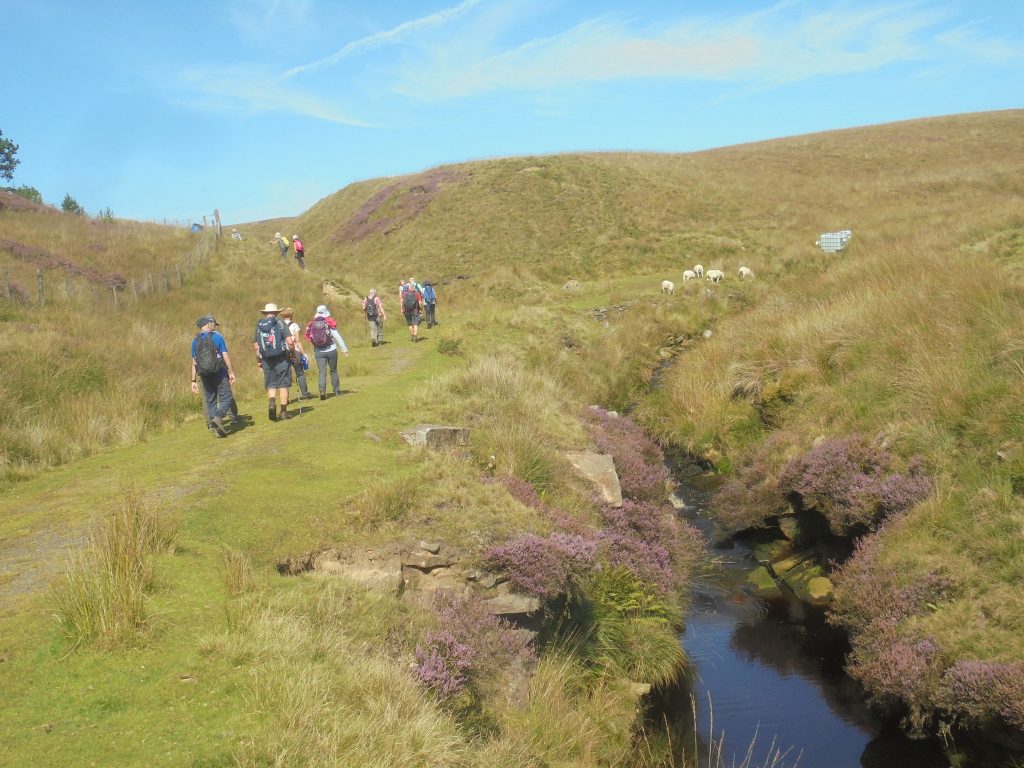
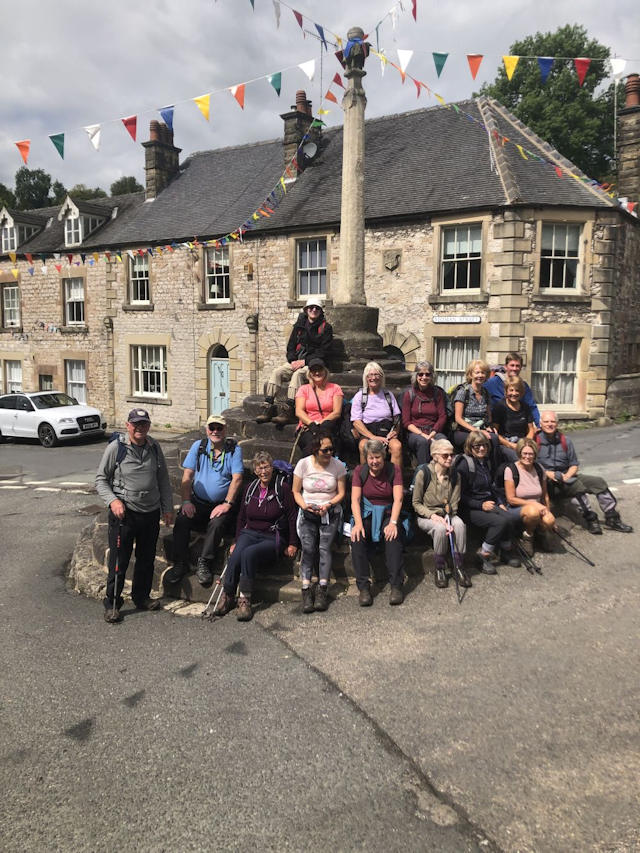
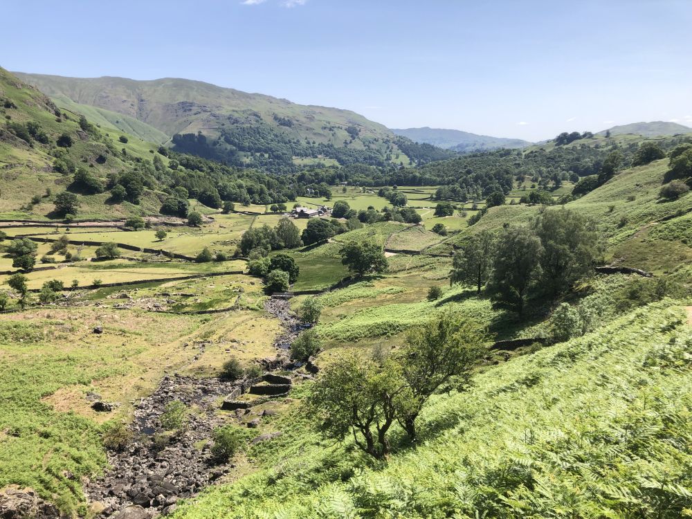
Frogall “Annual World-Famous Mince Pie Walk” 10 December 2023
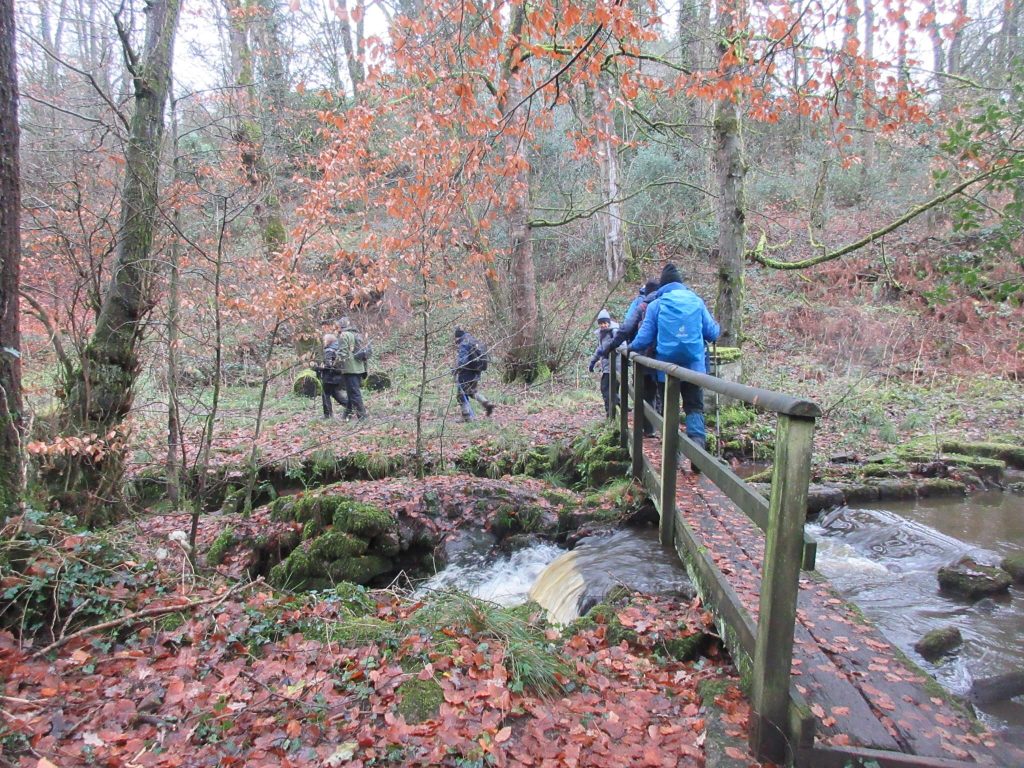
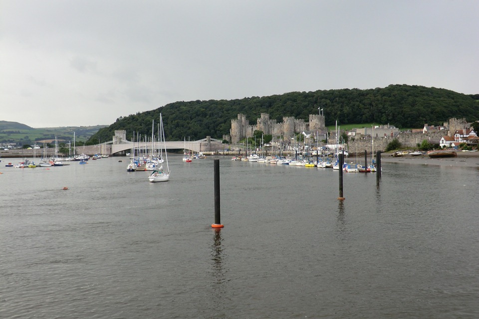
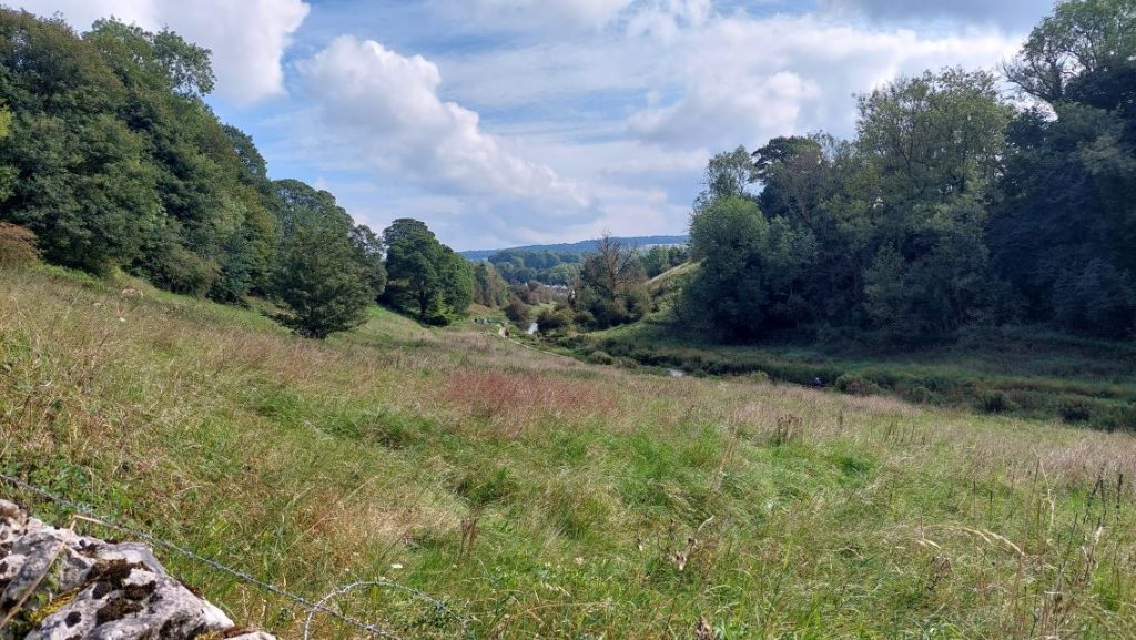
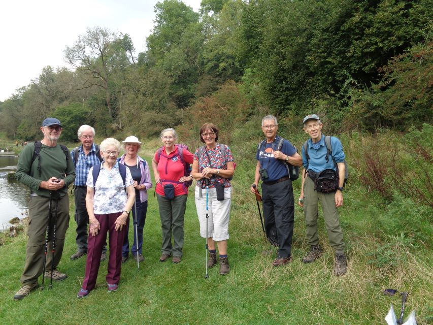
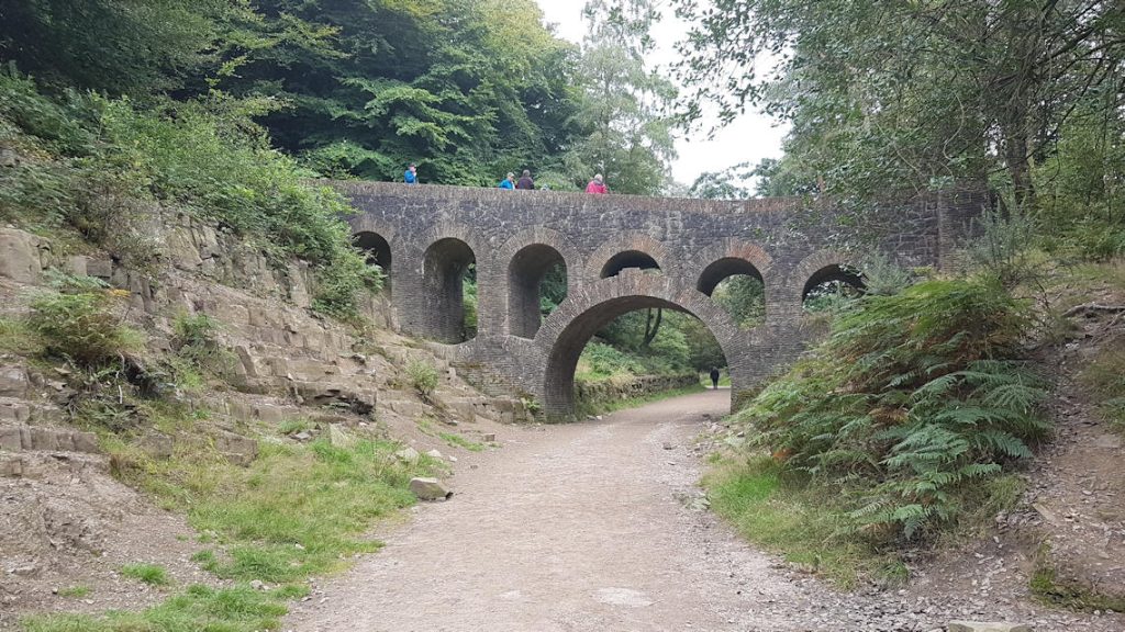
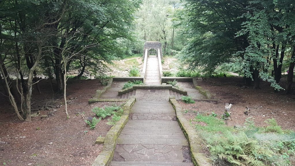
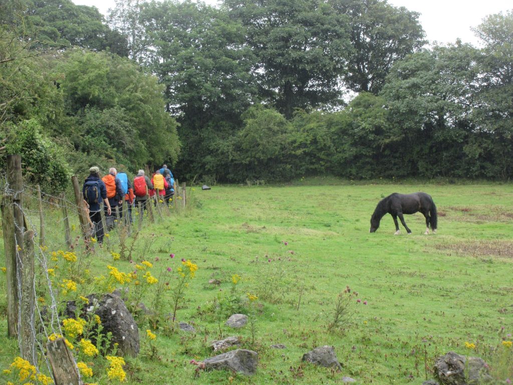
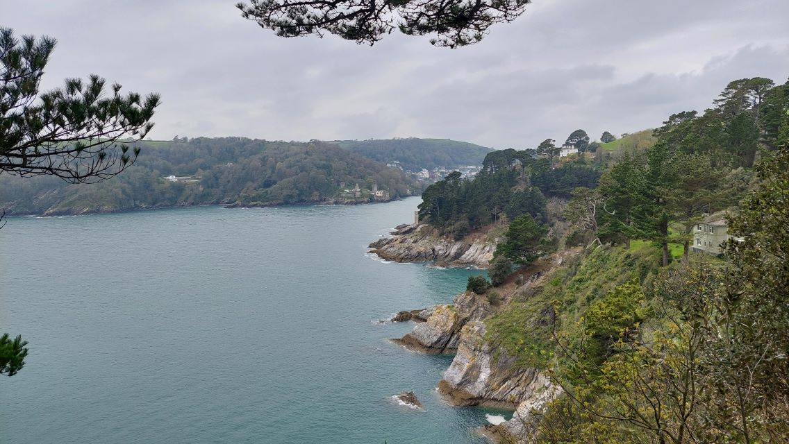
Plenty of water under the bridgePhil Mellor led the 12 mile A Walk.
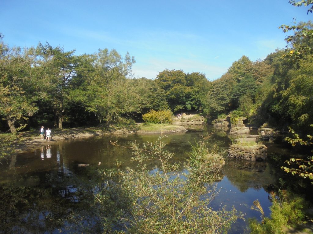
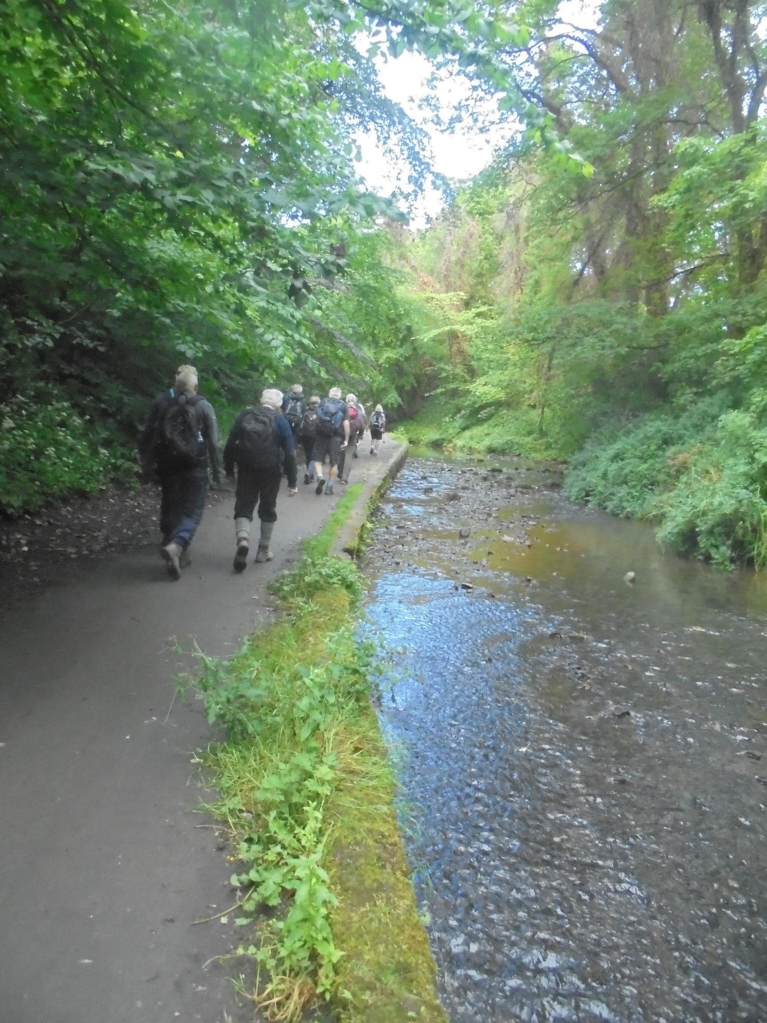
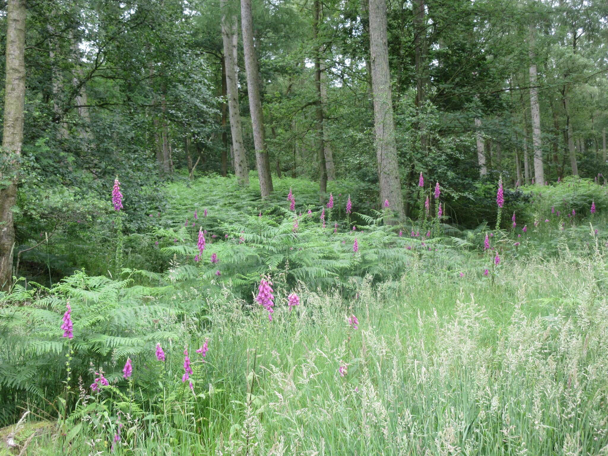
We start by walking up out of Froghall Wharf on the Staffordshire Moorlands Walk passing through woods and across streams before we reach high ground with good views over the surrounding countryside. At the small village of Foxt we will have our first break before we walk over quiet lanes and tracks to Ipstones. In the village we will stop again for our next break – this may be a bit early for lunch, but we have seats with a Christmas Tree and Decorations to enjoy our mince pies and mulled wine. Now we cross over fields to rejoin the Staffordshire Moorlands Walk with a bit of a surprise as we walk down the long drive to Sharpcliffe Hall before dropping down into Combes Valley Nature Reserve. We walk along the reserve and across fields to make our way to Cheddleton Railway Station and hopefully Santa will be on his Christmas Special train. Now we follow the Caldon Canal back to Consall and Froghall Whalf.
The B Walk was an easy 8 miles, and was led by Esther Williams.
Our route starts along what was once one of four tramways used to carry stone from the quarry at Caldon Low to the canal basin at Froghall Wharf and now forms part of Staffordshire Moorland Walks. We then descend to cross Shirley Brook before climbing back uphill towards the village of Foxt and a good vantage point with views of the surrounding area. From Foxt we head over to the village of Ipstones and a stop for lunch on the other side, before passing close to Grade II listed Belmont Hall and descending into the Churnet Valley via the Devil’s Staircase. Depending on time and weather there is the option to continue up the far side of the valley towards Hazzles Cross and back on to the canal or follow the canal all the way back to Froghall Wharf.
The area is hilly with steep wooded valleys and the route includes several ascents and descents often via steps to cross water courses. It also includes some lane walking to avoid the worst of the mud across country.
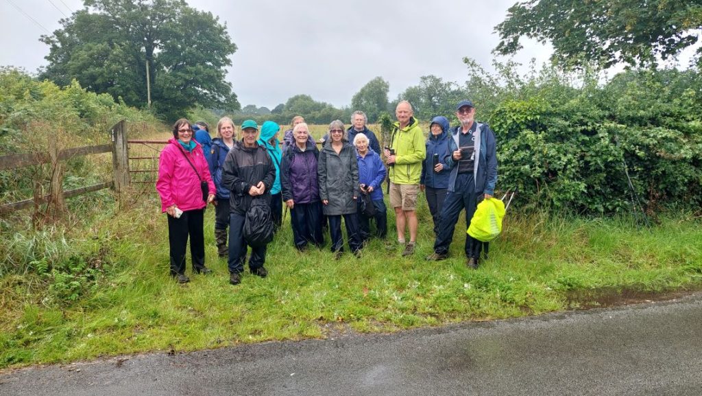
The C Walk was 5.6 miles, and was led by Kath Conroy and Marilyn Norbury .
A relatively short walk but when planned progress was slow as conditions were extremely muddy.
On arrival at Froghall Wharf the A & B Groups will commence walking from the Wharf but the C party will return to the coach after using the toilet facilities and the coach will take us to the village of Foxt to start walking. This will cut out some climbing.
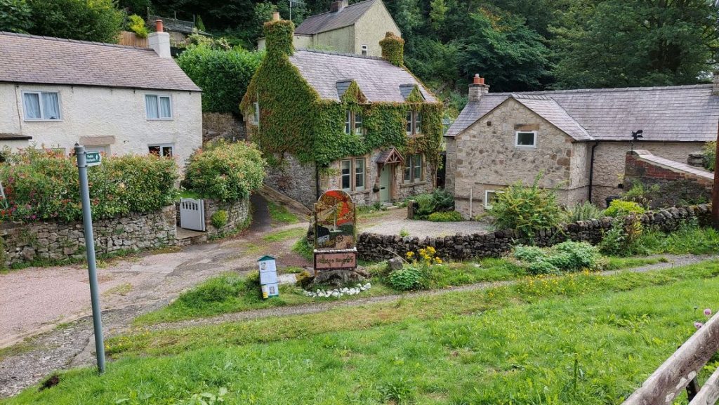
The route is over fields and woodland, passing through the village of Ipstones. We pick up the Staffordshire Moorlands Walk at Booths Hall and follow it to join the Caldon Canal and Churnet Valley Railway, near Consal Station. We follow the canal back to Frogall Wharf.
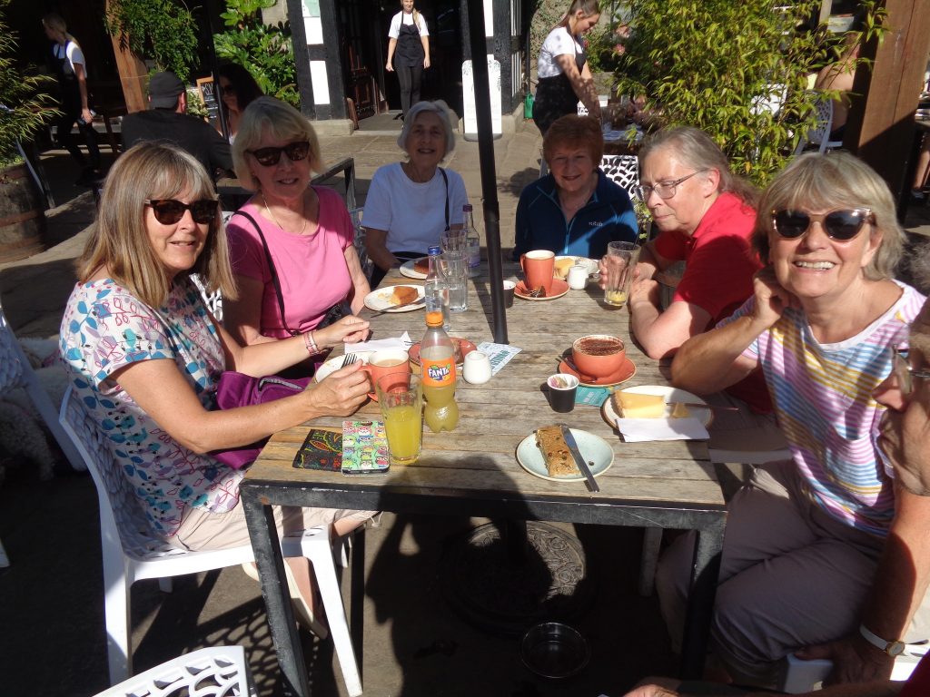
There is a cafe at the Wharf which closes at 4pm. The Railway Inn is 10 mins walk up towards the main road.
Mold (North Wales) Sunday 26 November 2023
The combined A & B Walk was an easy 8 miles led by John Moreton. This is an easy walk undulating walk devoid of steep climbs; however, it’s muddy in places. A scenic part of Wales, hosting the club’ first ever visit. Starting from the Glasfryn Inn on the outskirts of Mold we head towards Rhosmor with good views of the Welsh hills. The walk joins Wat’s Dyke Way passing through Northop and Soughton before returning back to the Glasfryn Inn.
Mike Martin led the 6 mile C Walk. It started at the ‘Glasfryn Inn’ car park on the outskirts of Mold. Unfortunately there are no toilets available at the time we intend to start. After leaving the car park we soon turn down a lane, and follow this for about half a mile, before taking to paths which are gradually rising
and offer good views to the Clwydian Range and Moel Famau. We pass in front of the grounds of Gwysaney Hall, and continue around the side. Shortly after a coffee break will be taken at a suitable spot.
Further on the height we have gained is all lost as we descend steeply through bracken and then woods (care needed as the ground may be quite slippery). Having lost all that height, there is a short steep climb up a hill. However we will try and take an easier route round this hill to get to the top.
Now on quite high ground there are good views again. We pass below Sarn Galed Farm and shortly after join ‘Wat’s Dyke Way’ for a while, passing Clawdd Offa and joining the A5119 briefly before taking a path to Soughton village. We pass through the village (mostly fairly modern housing) before
taking a path across fields to meet up with the A5119 again. Then down Raikes Lane to return to our starting point where the ‘Glasfryn Inn’ will now be open for refreshments.
Tittesworth and the Roaches Sunday 12 November 2023

Phil Mellor led the 12 mile A Walk.
Leaving the reservoir, we walk into the village to join the Staffordshire Moorland walk before turning off to head for the Roaches. At Don Whillans Memorial Hut we will take a break before climbing the set of steps to make the top ledge used by the rock climbers. Now we make our way onto the top with good views back to Leek and Tittesworth Reservoir and on the other side the Ramshaw Rocks [Winking Man]. Walking along the ridge towards Winkle we will stop at the Hanging Stone before we turn back to visit Lud’s Church. Making our way out of the church passage we head back to the Roaches where we join the country lane to make our way back to the Reservoir [to get back in time for the coach we use the lane as we have packed interesting features into the walk].
Mike Leydon led the 8.5 mile B Walk.
The coach will drop us off at the Tittesworth Visitor centre, where there are toilets.
We leave the Visitor centre and head towards the hamlet of Upper Hulme. Our route then skirts around the back (east side) of Hen Cloud, and leads us to the start of a short climb up towards the Roaches. After a short distance walking along the side of the hill, a second short climb takes us onto the top of the Roaches. This will reward us with excellent views (weather permitting) across the Cheshire Plain. We pass the trig point and then start to drop back down into the valley, where the walking is fairly flat on farmland/farm tracks. Toward the end of the walk, we enter the village of Meerbrook where there is a pub. The Visitor centre (and the waiting coach) is a few minutes walk beyond the pub.
This is not a difficult walk, but there is some rough ground on the Roaches and some very wet ground at lower levels.
The 5 mile C Walk was led by Carol Brown.
A 5 mile walk round the reservoir with the option of a 2 mile additional loop around the northern end, across farmland. The walk is mainly on graded paths though woodland and open areas with views of the surrounding area, including the Roaches. We will have our morning break at the Visitor Centre where there are plenty of seats available. The additional 2 mile loop is footpaths and fields which at present are muddy.
There are styles (not in good condition) and squeezes. It does offer however wonderful views of the Roaches.
Oswestry Sunday 29 October 2023.
Julie Shaw led the 12 mile A Walk.
A walk similar to one walked in spring, albeit shortened to suit the time of year and hopefully we will see Autumn colours in place of the first signs of spring.
We start by walking through the town passing the church to use a narrow path which leads to fields which gain height with views looking over the town. Now we use another lane to join the Offa’s Dyke path at the old race course and turning south we make our way to pass through the village of Trefonen. Then unfortunately due to the time of year we will have to miss the village of Nantmawr to make the next village of Treflach [this area has many Quarries with disused railway lines which served the Quarries]. Leaving the village we cross over fields to Treflach Hall where we join country lanes including Nant y Caws which is set in a picturesque valley. At Weston we join the Wat’s Dyke Way to make our way back to Oswestry.
Paul Davies led the 8.5 mile B Walk.
The walk starts at the lively market town of Oswestry, close to the Welsh border. After walking through the town we soon encounter the green pasture that Shropshire is renowned for. There are several short steep climbs in this part until we get to the Offa’s Dyke long distance path and into a dark, foreboding forest. We soon depart the forest, however, it being close to Halloween, and come across the 18th century horse racing course, where we have lunch. The race course was used from the early 1700’s until the 1850’s until the arrival of the railway allowed both animal and punter to travel further afield. There is then a mixture of field and quiet road walking back to the town centre, where a selection of pubs can be found. Oswestry’s story began with a 3000 year old Iron Age hill fort settlement, the evidence of which can still be seen, and an opportunity permits it to be experienced on the walk.’
Howard Gibson led the 6.5 mile C Walk.
Mainly flat and with some road walking involved. We will walk from Whittington in the direction of Shrewsbury, turn left and head towards the Narrow Boat Inn at Welsh Frankton. From here we follow the towpath towards Hindford then an alternative route back to Whittington.
Fairly straight forward and maybe a little longer than usual.

Conwy and Penmaenmawr Meal Walk Sunday 15 October 2023
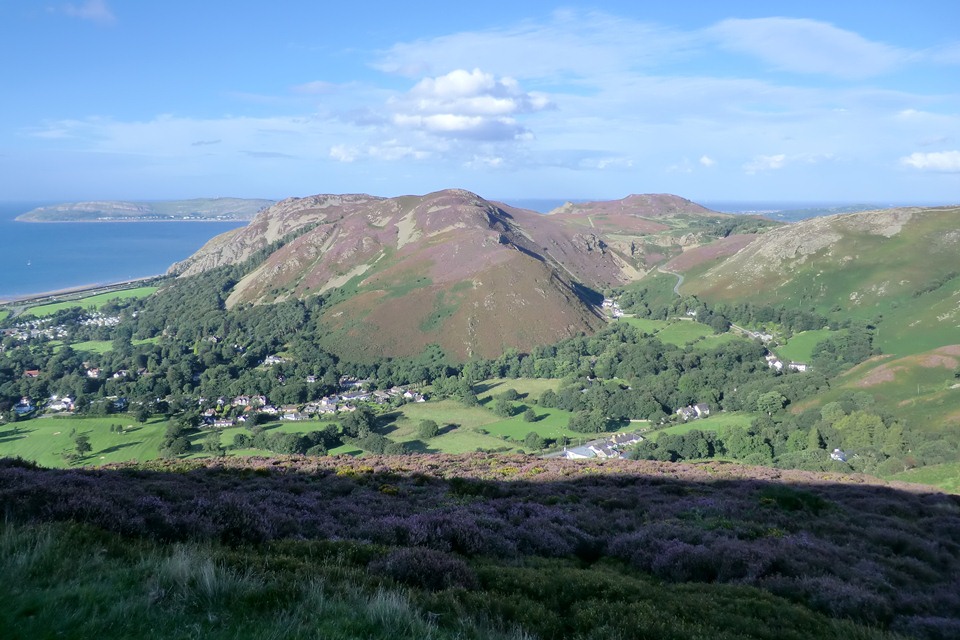
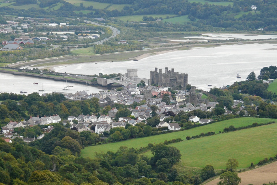
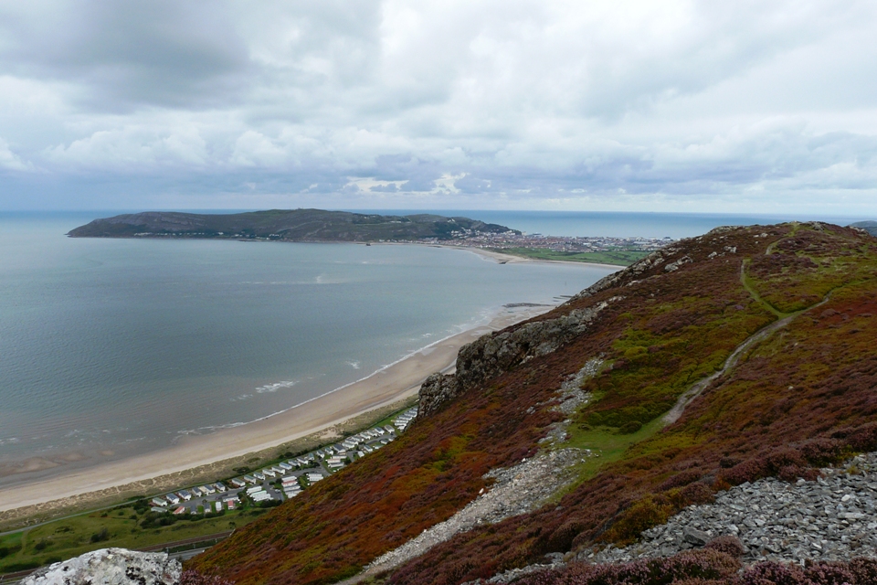
The A Walk will be a moderate 12 miles, and will be led by Yvonne Mason. We start our longitudinal walk at the Conway Nature Reserve walking alongside the Conway Estuary, crossing to the town by the side of the historic bridges making our way to the harbour [Toilets are available]. Continuing alongside the estuary passing the smallest house in England we eventually turn to make our way along the top path of the Conway Mountain. If the weather is good we will have 360 degree views over land and sea with Puffin island and Anglesey in the distance. Now a common sight on the mountains is wild horses which complement the sheep in keeping the bracken down. Dropping down into Sychnant Pass we use the bottom valley path with both sides of the valley towering up above us. Then onto Capelulo and Fairy Glen to gain height which again gives us great views over Penmaenmawr and out to sea. After a short steep climb we join the Wales Coast Path which continues with great views before we walk over the Penmaenmawr Moor passing a variety of Stone Circles. Dropping down into the town we walk towards Dwygyfylchi to the Hotel where we will have our Club Meal.
The B Walk will be 8 miles, and will be led by John Moreton. This will be an excellent walk on this stretch of the North Wales path, with a linear walk over Conwy Mountain and beyond towards Penmaenmawr.
We set off the same as the C group, past the castle and to the quay. We then go on the coastal path towards the mountain. There are stunning views on top, of the Great Orme and Anglesey, and a good chance to see some wild ponies. Crossing the Synchnant Pass we stay on the top for a few miles before dropping down to the sea front to meet the coach and pub.
The C Walk will be 6.25 miles, and will be led by Tony Whiffen.
A very picturesque Linear walk taking in views of Conwy’s 13th century Castle and the Quayside. Later we’ll have views of the Conwy mountains – there’s a steady incline towards the end of the walk, before a decent through a dry valley to the coach park near Penmaenmawr.
We leave the coach and walk towards the Castle before turning off the road to the Quayside, as well as quaint shops and Britain’s smallest house; there are views over to Llandudno and the Great Orme. Here we have a toilet stop before continuing on the same route as the B walk, we walk off the coastal route towards the Conwy mountains where we leave the B walkers to make their accent onto the Mountain. At this point we may have our first stop before continuing towards Mount Pleasant and on to Crow’s Nest where we will stop for our lunch (time permitting at this point of the walk). After lunch we continue across open ground and Moorland ascending towards Sychnant Pass, where we descend through a dry valley (option to descend along road) before continuing through a built-up area to where the coach is parked.
Unfortunately, there are no short cuts apart from the Sychnant Pass road which goes back to Conwy or on towards Penmaenmawr.
From the coach park there is about a ten minute walk the ‘The Gladstone’ Hotel.
Llangollen Sunday 1 October 2023

Phil Mellor led the 12 mile A Walk.
We start our longitudinal walk at Trevor and climb out of the village towards Tower Hill using the narrow country lane. Now we turn off the lane to pass over fields to join another lane which takes us to Sunny Bank Farm and the Top Reservoir. Passing through Newtown forest we join another lane to pass Pant-Y-Glas Reservoir before crossing the Ruabon Mountain to Worlds End. At Worlds End we will see the sight of Stone Age dwellings. Turning off the main track we follow the Panorama edge to the castle [Please Note this is a single width path with stunning views but care must be taken as the cliffs have a sheer drop]. We then have a few options to get back to Llangollen where we will have time to enjoy the town.
If the weather is poor, we will not use the top Panorama path but will drop down to join the Offa’s Dyke path but hopefully we will get good weather and enjoy the views over the Vale of Llangollen.
Michael Taylor led the 9 mile B Walk. To warm up the walk starts with an 800 ft climb to Castell Dinas Bran built in 1260 by “Prince Gruffudd ap Madoc”. After an even steeper decent the walk joins the Offa’s Dyke Path. Our first mile along the Offa’s Dyke follows the unclassified road before branching North across a well-defined path bounded by scree. The route then veers west across the valley to rejoin the unclassified road before veering west through woodland towards Tan-y-fron. We continue to hog the lower slopes of Fron Fawr whilst following the route back to Castell Dinas Bran. Maintaining height unveils some magnificent views westward across numerous valleys. Finally, we descend into Llangollen along the path that we ascended earlier in the day. We pass or event visit a very inviting Wharf Team Room alongside the Llangollen Canal.
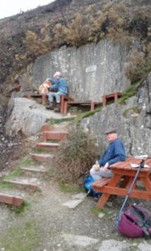
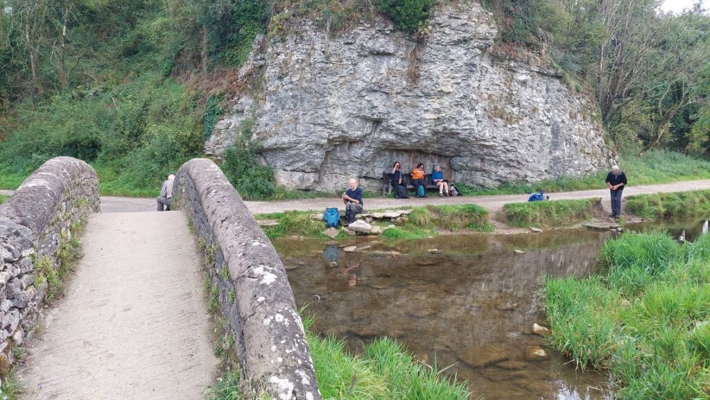
The 6 mile C Walk was led by Kath Conroy & Marilyn Norbury. There are toilets in the car park at Llangollen but 30p will be required. The walk begins by walking along the canal as far as the Horseshoe Falls and Llantysilio church. We then climb gently to Valle Crusis Abbey, where we will have lunch. After lunch there is just a little more climbing to our highest point. High seating is available:
The next part of the walk is downhill back to Llangollen. There are options to go up Castle Dinas Bran, skirt around the bottom the hill or even cut the walk slightly short and finish along the road.
Over Haddon Sunday 17th September 2023
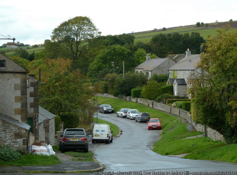
This beautiful village is situated in the Peak District, between Lathkill Fale and Haddon Hall, and offers spectaculor walks.
The A Walk was a moderate 12.5 miles and was be led by Phil Mellor. We started by walking down from the car park to join Lathkin Dale and then walked down stream past the old trout pools to Alport village which is part of the Haddon Estate.
Then we joined the Bradford Dale to walk to Youlgreave where we walked through the delightful village and then joined the dale again which is now part of the Limestone Way to Monyash. Coming out of the dale we gained height to look over the Derbyshire country side and the Dales below. After our gain in height we quickly lost height by stepping down into Cales Dale before climbing out to One Ash Grange Farm where some had locally made ice cream. Then we passed over the top of Fern Dale, and walked through Monyash to join the top of Lathkill Dale to walk back to Over Haddon.
The B Walk was 9 miles and was led by Bryan Clydesdale. We started our walk at the Over Haddon Car Park.
We then left the car park and walked downhill into the Lathkill Dale where we followed a path westwards alongside the River Lathkill. Reaching a footbridge we crossed the river into Cales Dale where we had a steep climb up a set of stone steps out of the Dale.
Leaving the Dale we joined the Limestone Way and walked over fields with cows and sheep crossing over several tricky stonewall stiles. We then continued to follow the Limestone Way down into the Bradford Dale where we followed the River Bradford eastwards passing various bridges and pools created by the weirs. We continued following the River Bradford passing Youlgreave and Bradford to Alport where we rejoined the Lathkill Dale and followed the River Lathkill northwards to the Conksbury Bridge where we crossed the river. We then had a short climb out of the Dale back onto fields and then walked back to the Lathkill Hotel and the car park.
The C Walk was a moderate 6 miles, but with a challenging end. It was led by Carol Brown. We set off through the village and crossed farmland using a mix of squeezes, gates and stiles. We had lovely panoramic views of the Wye valley and Haddon Hall. We then descended to Alport and went part way up Bradford Dale where we stopped for lunch before returning to Alport and then along Lathkill Dale, with lots of wildflowers and wildlife, before the final ascent back to Over Haddon.
Below is the view from the Lathkill Hotel.

Rivington (Lancashire) Sunday 3 September 2023
Rivington Terraced Gardens were originally created for soap magnate Lord Leverhulme as a spectacular venue for him to relax in and entertain.
The suffragettes set fire to Lord Leverhulme’s house in Rivington in 1913. Rivington Country Park has easy woodland paths, moorside walks and spectacular hill top views. Old buildings include Rivington Pike, The Pigeon Tower and the remains of Lord Leverhulme’s Zoo.
The A Walk was a moderate 12.5 miles, and was led by Phil Mellor. We started by walking to the Hall Barn to walk up to the Tower passing the Japanese Lake, Terrace gardens, Italian gardens and the Pigeon House. Then we crossed over the Rivington Moor to pass the Winter Hill masts which supply our radio, television and communication signals to the North West. We then made steady progress across Anglezarke Moor following the Lancashire Way before turning down to Drinkwaters at the Great Hill. At Drinkwaters we passed the remains of cottages used by crofters before we again turned back to walk along the side of the reservoirs at White Coppice. After our moor walking, we had a relaxing walk past Anglezarke, Upper and Lower Rivington reservoirs before we ended the walk at ‘Go Ape’ and the Lower Barn Cafe.
The B Walk was about 9 miles, and was led by Esther Williams. The walk started at Rivington Park Visitor’s Centre toilets. We had a steady climb to reach The Pike from where we could see, as far as Blackpool Tower, the Lake District and the Isle of Man. The historic Pike was part of a system of early warning beacons and in 1896 was included in The Winter Hill mass trespass to enforce the public’s right to roam. We then made our way down through the remains of the terraced gardens built for Lord Leverhulme, into the village of Rivington, then through fields and woodland to reach Lead Mines Clough and the monument dedicated to the crew of a Wellington Bomber crash in 1943. There were good views of Winter Hill from here. We continued uphill beside Limestone Brook and out onto the edge of Anglezarke Moor to reach another viewpoint at the Pike Stones before we made our way back down alongside the Yarrow Reservoir.
The C Walk was an easy walk 5.5 miles and was led by John Moreton. It started from the Barn Visitor Centre, where there was a cafe and toilets. We then followed the reservoir to the ruins of Liverpool Castle through woodland. We then climbed up steadily to the Japanese Gardens for lunch. Then we dropped down to Rivington Hall Barn, and the reservoirs, where there is a pub called The Rivington near the end. It was then a short walk back to the coach.
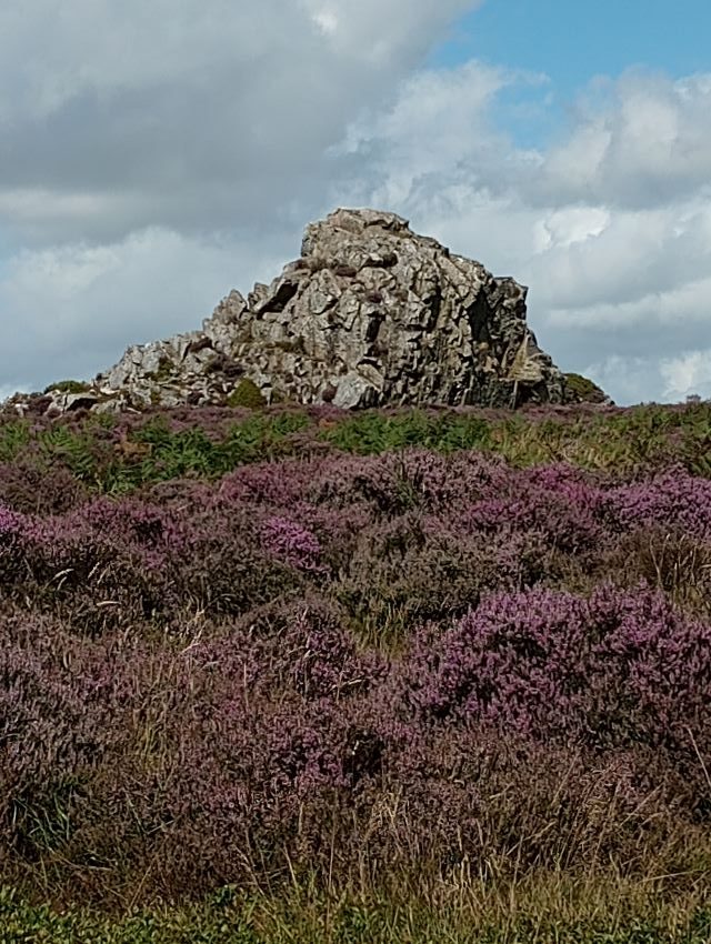
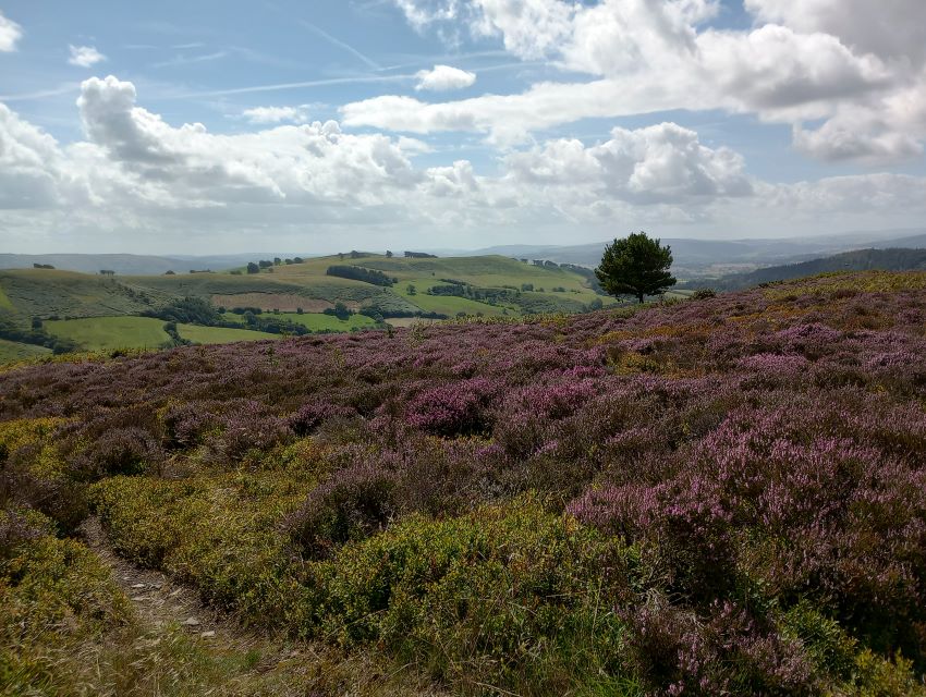
Stiperstones (Shropshire): Sunday 20th August 2023
The A walk was a 12 miles and moderate, and was led by Phil Mellor & Julie Shaw.
We started at the Bog visitor centre and walked through the remains of the mining village to the rock where we joined the Shropshire Way. Walking along the Stiperstone Ridge passing Cranberry Rock, Manstone Rock and Devils Chair we made our way to Blakemoore Village. At the village we went back in time to see how the local people liveded off the land as cottages have been preserved. We then made our way to Snailbeach where we had time out to view the mine workings including the museum, compressor house, blacksmith forge and the sight workings. We made our way back to the Bog using parts of the road and paths parallel to the road passing Crowsnest, Stiperstones and Tankerville.
The B walk was about 9 miles, and was led by Ruth Beach. We parked at The Bog car park were there is a very nice coffee shop, with good cakes and some local crafts to buy. The walk was a figure of eight walk with fantastic views across Shropshire.
We started with a circuit of the Nipstone Rock ridge then there was a short descent before our only bit of uphill road walking. After passing Knolls
Farm which has become derelict, we reached a carpark. From here we started our ascent of the Stiperstones, with many interesting rock formations.
We then descended a gradual path down to Brook Vessons Nature Reserve and then back up to the ridge at Blakemoor Gate. From there we had a short ascent, but it was a very easy path, with good views of the Stiperstones ridge all the way back to The Bog car park.
The C walk was a moderate walk and was led by Tony Whiffen.
The Stiperstones are a ridge of Quartzite deposits formed some 480 million years ago.
We started the walk at the car park near the Bog Centre and soon walked through to ruins of the old lead mine before taking the level path through the woodlands. As we left the woods and crossed open ground we came to a track and started our gentle accent up to higher ground, this accent took us onto a section of the Stiperstone ridge with heather and ferns in masses along our route. We then made a steeper accent across open ground, which tooks us onto the ridge. Once at the top we crossed the Shropshire Way and from then on it was all downhill on a gravelled track through to the Bog Centre and its café. The Centre tells the story of the Lead mining village which ceased production around 1911. The scenery on this walk was stunning.
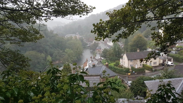
Matlock (Derbyshire): Sunday 6th August 2023
The A Walk was 12 miles, and was led by Phil Mellor.
We started by joining the Limestone Way at the back of the railway station and then climbed up the first of three climbs of the day. After passing through wildflower meadows we reached the top of the hill where we had good views over Matlock Bath and Darley Dale. We then went to the pretty village of Bonsal.
Dropping down to Via Gellia Mill we then went up our second hill of the day to enter the village of Middleton. We then joined the High Peak Trail which is the dismantled railway. Walking along the old track we have great views over the valley and pass the Winding House for the incline and at the bottom we join the canal to walk into Cromford where we viewed the industrial history of Arkwright’s Mill, walking along the road into the ‘Blackpool of Derbyshire’ – Matlock Bath. On our third climb we passed the Cable Car wheel house to make the top of High Tor where we walked along the gorge edge.

We then dropped down, following the Derwent Valley Way, into Matlock Gardens and back to the coach.
The B Walk was 9 miles, and was led by Bryan Clydesdale.
From Matlock we followed the Limestone Way climbing steadily through many squeeze stiles with spring gates. We had good views of Matlock and the surrounding countryside before dropping down into Bonsall.
Leaving Bonsall we climbed a long flight of steps to Uppertown. Then leaving the Limestone Way we walked around a large old quarry dropping down into Wensley. The name Wensley derives from Woden, the Norse God of War. From Wensley we walked down through Wensleydale (not a cheese factory in sight) to Darley Bridge. Here we joined the Derwent Valley Heritage Way and walked alongside the River Derwent back to Matlock.
The C Walk was 4 miles, and was led by Maurice Drake and Tony Whiffen.
We left the Old Bus Station and followed the River Derwent westwards and passed a disused quarry, before ascending through the woods at Oker and approached Wensley. We then climbed steadily past Brightgate and then approached Upper Town. We then descended gradually from Upper Town and followed the Limestone Way back to the Old Bus Station.
Warmingham: Thursday 27th July 2023
This walk was led by June Winby and Barbara Steele.

We enjoyed a meal in the Bears Paw after the walk.
Prestatyn (North Wales): 23rd July 2023
Walk “A” was led by Phil Mellor.
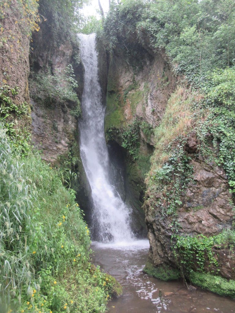
This walk visited two water mills one with an impressive waterfall. We started at the top of the town by joining the Offa’s Dyke Path which climbs to give us great views over the town and the coast. Dropping down we then used the North Wales Path [this was the old rail track that was used by the Quarrys] to walk into the town of Dyserth. We enter the town by walking down from the top of the Waterfall where we will had lunch. On passing through the town we walked to the secluded village of Cwm and again joined the Offa’s Dyke Path to start our return to Prestatyn. After walking over fields we then passed through the valley of Marian water mills before leaving the path to use the road to Gwaenygor, and then returned to Prestatyn.
Walk “B” was 8.5 miles and was led by John Moreton.
We started from the town crossing the railway and headed for the Nova Centre on the coast, where the Offa’s Dyke starts / finishes. We then walked along the promenade for about 1.5 miles, then heading inland for a stop, before crossing fields to the hills. We skirted them to Dyserth and stopped by the famous waterfall for lunch before heading back on the Offa’s Dyke path over Prestatyn hill with great views at the top before dropping down to the town.
Walk “C” was 5.5 miles and was led by Mike Martin.
We started the walk from Prestatyn Bus station. We headed for a tarmac path which is on the route of the former railway to Dyserth and followed this on a gentle rise for about 30 minutes until we reached the golf club near Meliden, where we stopped bt the light refreshment kiosk.
Here we turned off across fairly flat countryside paths towards the coast with good views on the way. On reaching the coast we turn right and head along the sea front to the Nová Centre. We then turn right on the road which is the start of the Offa’s Dyke Path towards Prestatyn town centre via a bridge over the railway station.
Buxton (Peak District): 9th July 2023
Walk “A” 12 miles – Phil Mellor
We started at the Pavilion Gardens and walked out of the town to reach the main A5004 road. Walking along the road we had good views back over the town until we reached the old Roman road which is now designated the Midshires Way. After crossing the Goyt Valley between Errwood and Fernilee reservoirs we walked up towards Pym Chair, before turning off towards Errwood Hall.
We then visited the Shrine, erected in memory of Miss Dolores de Ydarguen a Spanish aristocrat, who was a governess to the Grimshawe family, and then we made our way to the Grimshawe family private ground to admire the views.
Then we visited Errwood Hall [built in the 1830s by Samuel Grimshawe, demolished in 1934 with the stones used to build Fernilee reservoir] which is now in ruins with the usual ghost stories. Joining the path along the Errwood reservoir we walked to the source of the River Goyt and walked over the Goyt Moss and back into the town.
Walk “B” 9 miles – Ruth Beach
From Burlington Road we followed the River Wye and then crossed over the road up to the Cavendish Golf Course. We then ascended to Watford Farm and then up on to the open moor where we had our first stop.
From there we crossed Burbage Edge, with good views. We then kept high for a while and then dropped down towards Buxton. We then followed a path round to the entrance to the Grinlow Country Park.
We then followed tracks, passing Stanley reservoir and then towards Harper Hill. Then we ascended up to Solomon’s Temple, where we had a stop. Then it was downhill past the centre at Poole’s Cavern, back to the centre of Buxton.
Walk “C” 6 miles – Bill Pearson
This was a 6 mile walk which was moderately easy but had a steady climb up Grin Low.
We proceeded to Poole’s Cavern and Buxton Country Park, where we had an early first break. We then walked through the delightful Grin Woods, to Grin Low (which is also called Solomon’s Temple).
The final walk to the top, was through lots of orchids.

We then came down the hill, walking past Buxton Hospital, to Dukes Drive, and across the fields to Staden Low. We then visited Lovers Leap.
We returned along the River Wye through Ashbrook Park. We could see a statue, dedicated to Jack the Quarry Man.

We then walked through Buxton’s main shopping area (with lots of places selling tea and coffee), and past St Ann’s Well and the Opera House to the Pavilion Gardens.
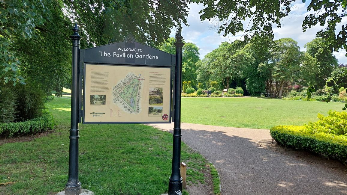
In the Pavilion Gardens, we saw the boating lakes, a miniature railway, an art gallery, and ice cream parlour, a gift shop and café and the Botanical Conservatory.
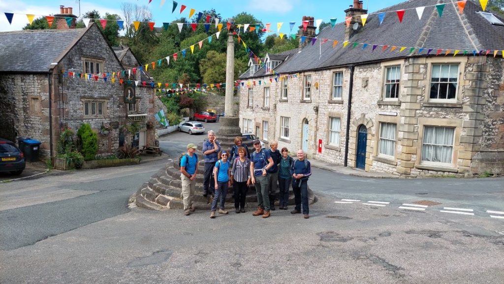
Pontesbury (Shropshire): Sunday 26th June 2023

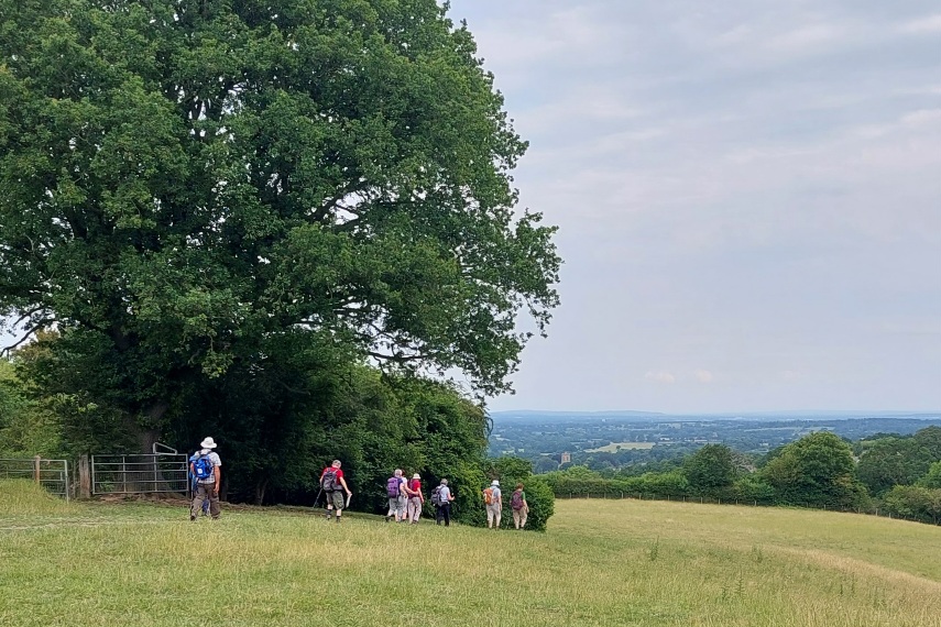
The A walkers joined the B walkers, with a 9 mile walk led by Mike Leydon. This was an undulating walk in Shropshire countryside. The walk started at the Plough Inn in Pontesbury, and largely followed the route of the Chris Bagley* walk. We headed out on Pontesbury Hill toward Lees Coppice. In a small clearing local school children have incorporated ceramic tiles into a wooden sculpture. The route then took us into Maddox’s Coppice where there is a long, but not steep, climb out of woodland into open fields with great views of rolling countryside. We then swung back round towards the small village of Habberley.
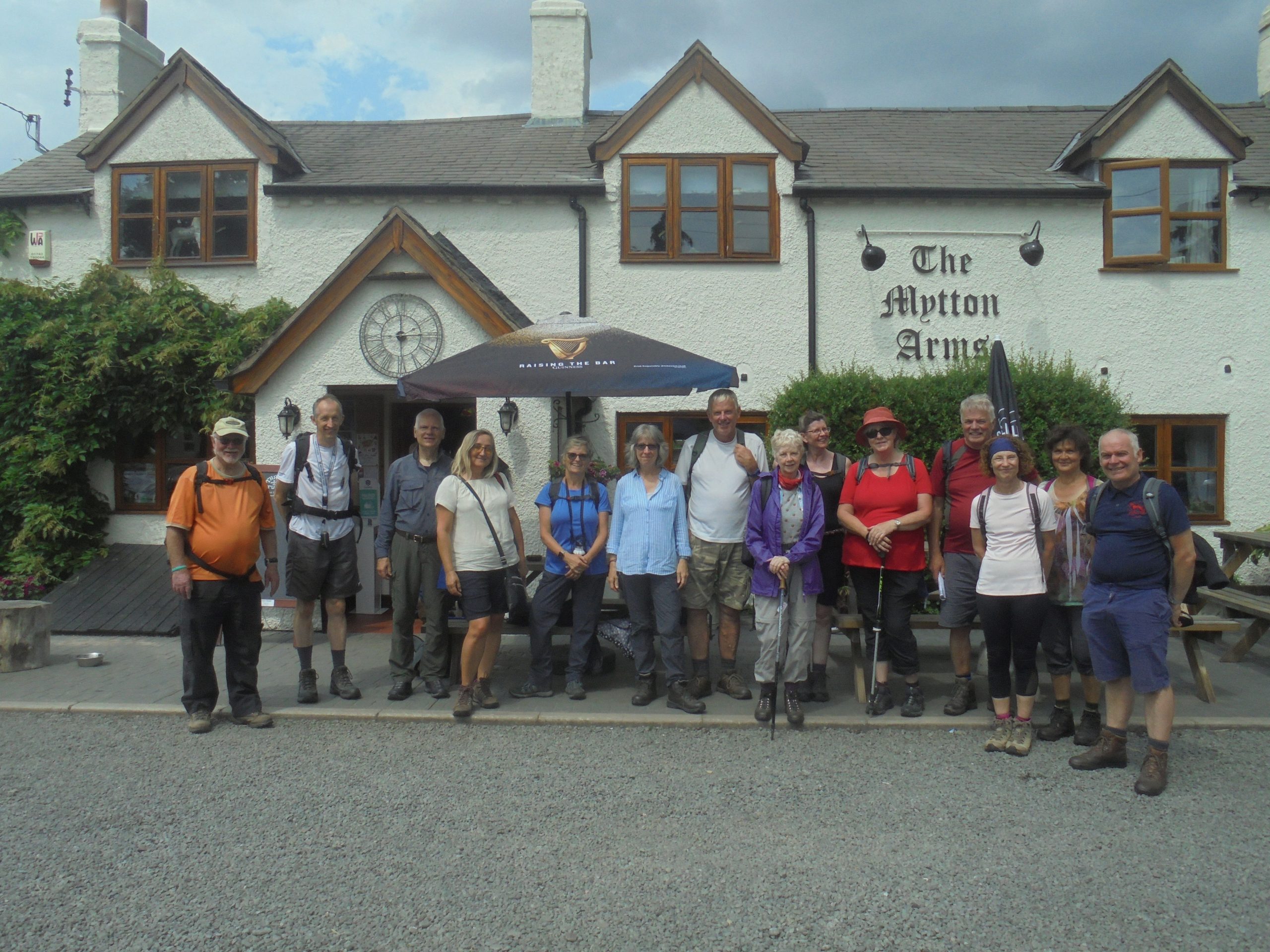
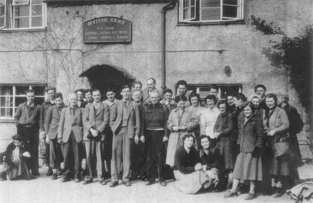
It’s interesting to compare the above photo, taken outside the Mytton Arms, with the one below, taken in the early days of the club (we think around 1949):
After passing the Mytton Arms, we crossed open countryside and then skirted round the side of Earl’s Hill/Pontesford Hill, back into Pontesbury.
*Chris Bagley was a local Parish Paths Partnership or ‘P3’ liaison officer with Shropshire County Council.
The C walk was a 6 miles walk, led by Carol Brown. We started by walking through Pontesbury and crossing the A488. A short distance along the lane we turned onto a disused railway line (this is a permissive path) and once out of the cutting there were some lovely views. Our route then took us across farmland following the Minsterley brook, with flowers, butterflies etc. for us to look at. We had our lunch stop in Minsterley. After lunch, the route took us up gently towards Callow Hill and then there wass a short uphill climb to the lower slopes of the iron age fort before gently downhill to Pool Bank. There were more fields to cross before returning to Pontesbury.
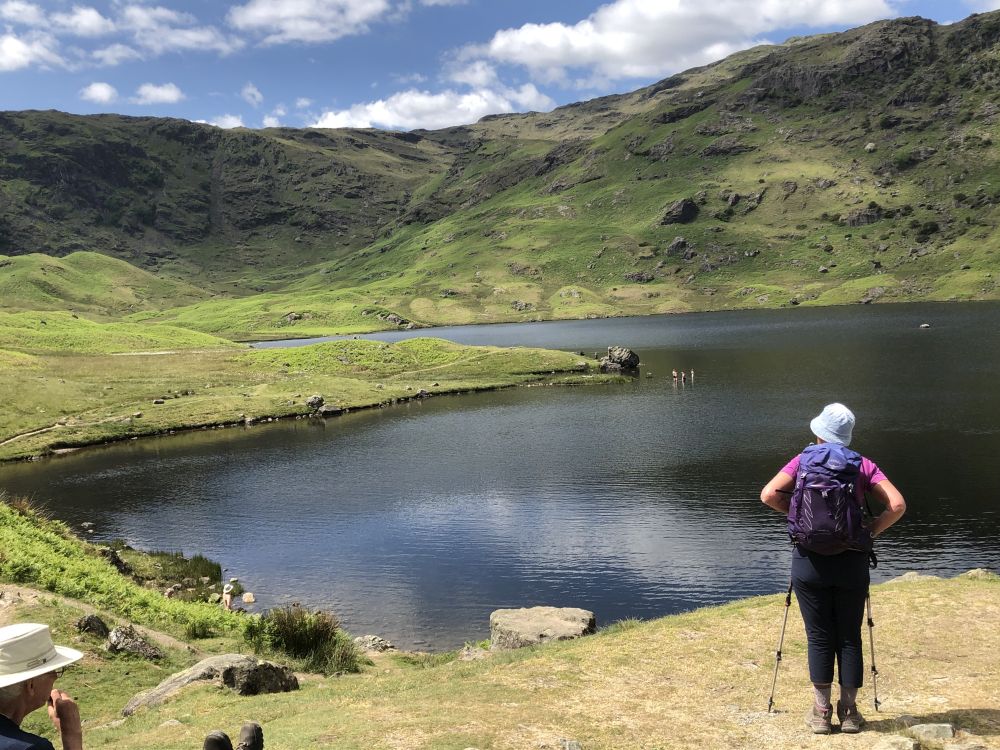
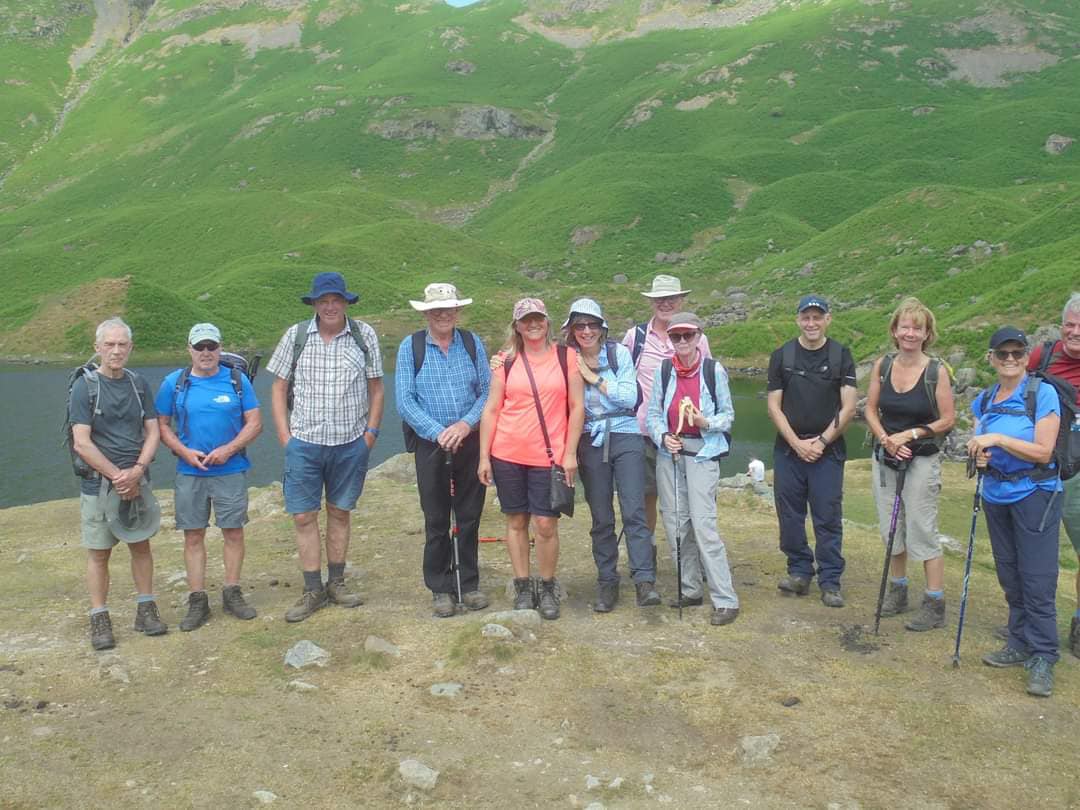
Grasmere (Lake District) Long Distant Walk: Sunday 11th June 2023
Walk “A” 12 miles (Longitudinal) – Moderate / Hard at times for short periods – Phil Mellor.
We start at Ambleside with a steady climb with some rocky sections which require concentration with foot placement. We have plenty of time to rest and take in the views over Windermere and Coniston Water as we make our way past Low & High Pike, Dove Crag and Hart Crag. When we reach Fairfield we should have good views of Helvellyn, Red Tarn and the surrounding area. Now we will be walking down passing Great Rigg then taking the side route down to Grasmere. On our way down we have good views over Rydal water, Grasmere and Easedale Tarn before we walk into the village and the coach for our return.
Walk “B” 8.5 miles – Bryan Clydesdale
We start by passing through the busy town of Grasmere with its many shops and cafes etc. We leave the town on a short footpath that takes us to the Easedale Road which we will follow till we cross a footbridge over Easedale Beck joining the footpath that will take us to Easedale Tarn. We now have a steady climb up the rocky footpath for several miles to reach the Tarn. We will walk a circuit of Easedale Tarn before descending a different rocky footpath which takes us down to the Stythwait Steps. There we join another rocky footpath that returns us to the Easedale Road where we follow a short footpath that goes around Grasmere and back to the coach park.
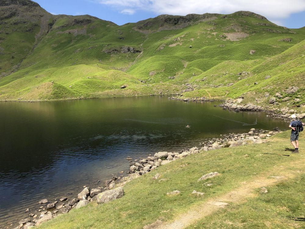
Walk “C” 6 miles – Strenuous – Ruth Beach
The walk is up to Easedale Tarn and then return the same way, so if you do not feel able to complete the walk you will be able to wait for the party to return or make your own way back to Grasmere. Please inform the walk leader should you decide not to continue. The walk is up through beautiful Lake District Scenery passing waterfalls, which unfortunately may not be as spectacular as they could be. There is certainly a wow factor when you reach the rim of the tarn.
Hope (Derbyshire): Sunday 28 May 2023

Marlene Flannery lead the A Walk. The walk began by following a gentle footpath into Castleton where we then picked up a minor lane taking us up towards Hollins Cross. From here we had spectacular 360-degree views of the valleys below. We then took a footpath down towards Edale. We then retraced our steps to then follow footpaths along the Vale of Edale, passing picturesque rental properties along the way, until we reached Jaggers Clough. We then climbed up to the next excellent viewpoint & took footpaths and the remains of an old Roman road towards Winhill Pike, from where we could see the Ladybower reservoir. Then, it wass downhill all the way back to Hope.
John Moreton led the B Walk. This was a varied walk, starting from the village of Hope. We headed for the hills, climbing up to Win Hill – the highest point of the walk, with extensive views, including Lose Hill (not to far away). After a break, we then dropped down to Ladybower Reservoir. 
We walked along it for a few miles, and had a lunch stop there. We then went back through the Derwent Valley across fields back to Hope.
Tony Whiffen and Mike Martin lead the C Walk. After leaving the coach we made our way through a residential area before picking up the main circular walk. We headed north crossing a railway line that feeds the cement works in Hope and here we have a steady but extensive climb towards Losehill Farm. From the farm we have amazing views of the surrounding hills including ‘Mam Tor’ and Castleton, the highest point of the walk. From here we went to Castleton. We walked a short distance through the town before picking up the footpath again towards Hope, and across lovely countryside with the river winding on our left, here we had a closer view of the cement works before we cross the railway again and head up into Hope.
Church Stretton (Shropshire’s “Little Switzerland”): Sunday 15th May 2023

The A Walk was led by Yvonne Mason. We started by walking up to Cwms using the farm track before turning off over fields and reaching the picturesque village of Enchmarsh. We then continued by walking along farm tracks and narrow lanes to reach Hoar Edge and Lawley. Climbing steadily up we went to the top of the Lawley hill with a height of 377m before dropping down to the village of Comley. Then we climbed to Little Caradoc at 327m before making Caer Caradoc Hill at 459m. On joining the farm track we walked down retracing the steps we took on our way up, and went back to the town. Please note this walk will be good practice for our Grassmere walk.
The B Walk was led by Peter Epton. The walk started from near the Railway Station/Bus Park. We crossed the A49 and walked up Hazler Road. We then took a steep climb up to Gaer Stone, where we had our coffee stop. Carrying on we kept to the ridge of Hope Bowdler Hill where there are great views. We proceeded to Willstone Hill, and crossing several fields, we dropped down to a concrete track and tarmac lane into the village of Cardington. After a lunch stop in the Churchyard, we left the village and reached the ridge of the Wilderness before dropping down to a hardcore track, Cwms Lane. Keeping on this track we pass a large pool at New House Farm, and then followed a metalled road back to the coach.

The C Walk was led by Kath Conroy. We crossed the railway and left the town through parkland and crossed the A49. The first part of the walk was a steady climb, crossing fields and passing through woodland to eventually reach our highest point below the slopes of Caer Caradoc. We then crossed open ground and skirt around the lower slopes of Willstone Hill and Hope Bowdler Hill.
During our walk we came across a Vending Hut, a somewhat challenging new experience and requiring purchase by card only!!

After passing below the Gaer Stone we continued round the foot of Hazler Hill and returned to the town.

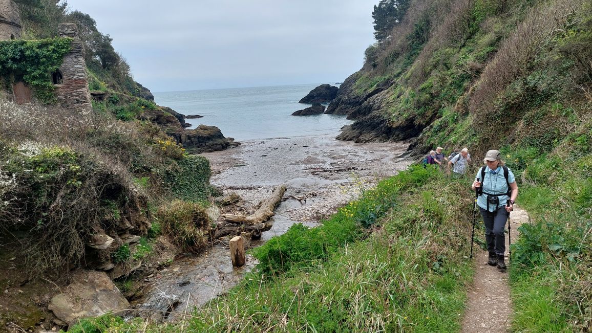
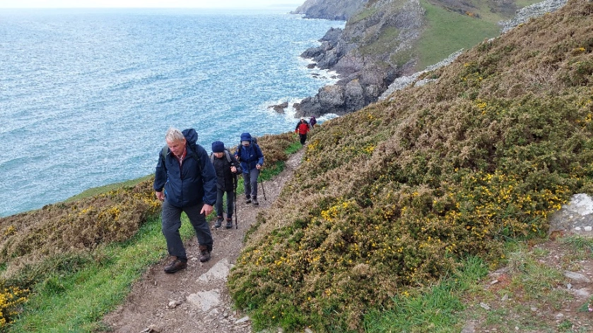
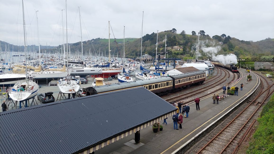
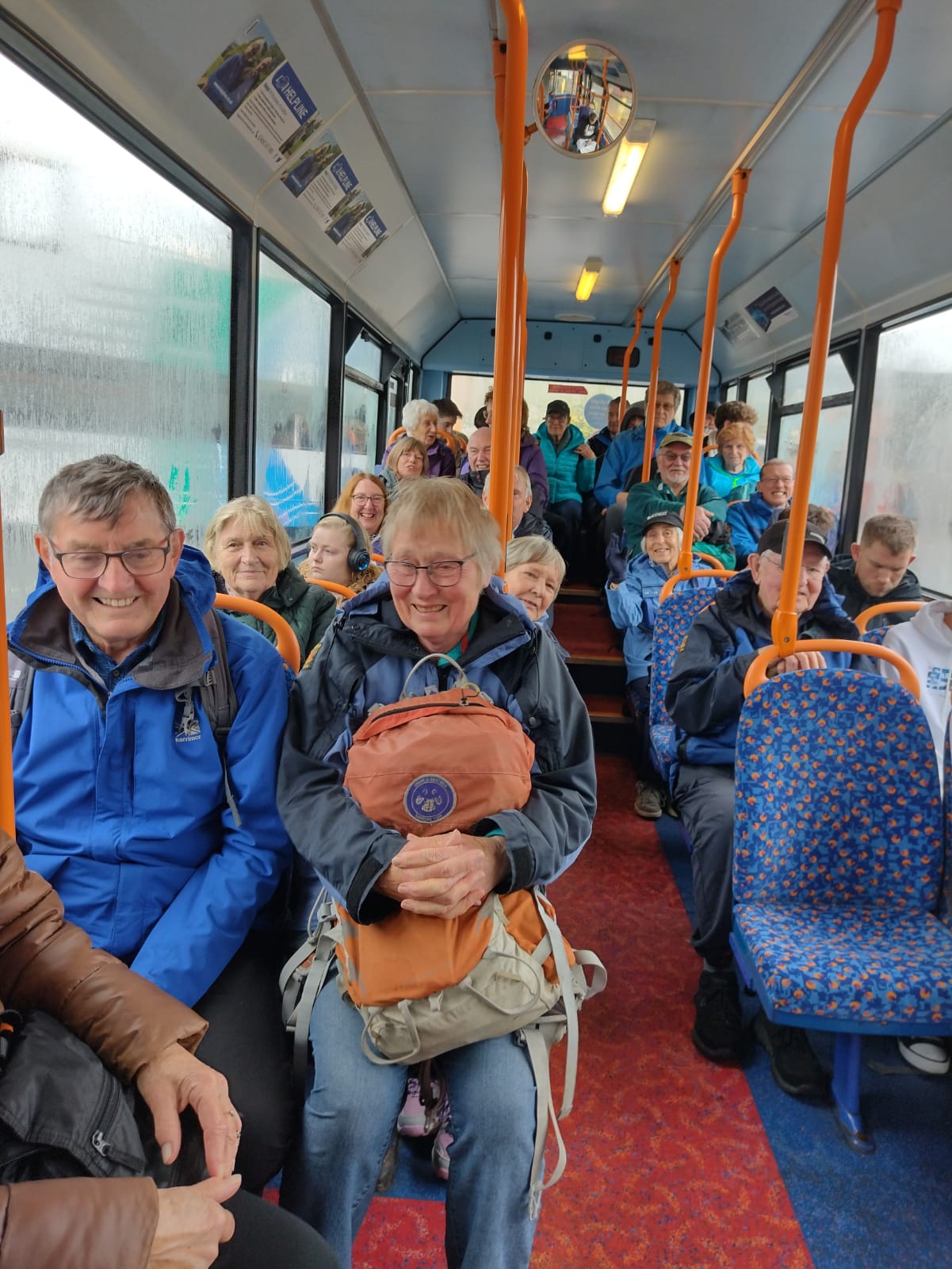
Torquay (Club Holiday):
We had a fantastic holiday in South Devon.