Click here to see photos of our recent walks.
Chirk 10 November 2024
A Walk – 11.5 miles – Leader Mike Ravenscroft
We start at Colliery Lane car park, Chirk.
This is a pleasant walk with very varied landscape. It is strenuous in places with a few steep climbs but on a clear day will offer some wonderful views. Unfortunately, on the recee day it was quite misty which somewhat spoilt the views.
We start by walking along the road and soon cross the Llangollen canal and make our way towards Chirk Castle. We walk across lovely meadowland which offers us glorious views of the castle. We walk alongside the castle and soon pick up Offas Dyke and we remain on there and head towards Craignant. We then walk across a further varied landscape and head towards Selattyn with it’s lovely church which has reference back to 1291. This will possibly be our lunch stop. We then follow a pleasant mix of farmland and meadowland as we head back towards Chirk. We were escorted by a landowner through a herd of goats and warned about one very friendly but frisky goat but she wasn’t interested in us !
B Walk – 8.5 Miles – Easy going, No stiles – Leader Paul Davies
The adventure starts from the little Welsh town of Chirk. There are free toilets at the beginning of the walk. It is an easy route with few hills and no stiles.
We leave Chirk and after a short time arrive at the Llangollen canal. Here we cross Thomas Telford’s 70-foot-high aqueduct built in 1801. It has a wide path and a handrail for safety. After crossing the aqueduct, we walk through Telford’s 460-yard canal tunnel, also built in 1801. The tunnel is pitch black inside, but there is a good path with a safety rail to prevent you from getting wet. It is advisable to bring a torch. The roof curves in from our right side and is quite low, so be careful. Shortly after, we walk through another tunnel, but this one is much shorter.
After all the excitement, it’s a gentle couple of miles along a good canal towpath, where we will be having our first lunch break.
On leaving the canal towpath, we cross some fields until we arrive at Offa’s Dyke trail. The dyke was built in the 8th century, originally an 8-foot earth mound in front of a big ditch, built by King Offa of Mercia, just to inform the people of Powys which part was his.
Luckily, we shan’t be walking all 177 miles of it, as after a few of those miles we arrive at historic Chirk Castle.
Chirk Castle was built in 1399 as part of a chain of fortresses on the Welsh/English border by someone with more money than thou. There are tables and toilets at the castle, and it is here that we shall have our main lunch. Afterwards, we may take a little time exploring the castle.
The walk continues around the castle grounds where we have the opportunity to see an ancient sweet chestnut tree, over 25 feet in circumference, that probably dates from the early 16th century. We leave Chirk Castle estate via the imposing wrought iron gates built in 1719. It is then a short trip over fields and back to the town of Chirk.
C Walk – 6.5 miles – Leader Bryan Clydesdale
We start the walk in Chirk Car Park where there are toilets.
We walk along Station Road heading for the Chirk Station. Leaving the station we continue on and pass the impressive Chirk Castle Gates. We now continue across fields heading for the Chirk Castle. Passing the castle we will eventually join the Offas Dyke Path which we follow through the woods to the River Ceiriog which marks the border between Wales and England. We cross over a bridge which was the area of the Battle of Crogent to join the Maelor Way which we follow along the river passing the Pont Faen Bridge.
We eventually come arrive at the Chirk Viaduct which we will pass over crossing the railway line and now we are heading back to Chirk walking along the Llangollen Canal towpath which now crosses the Chirk Aqueduct. We continue along the canal towpath through the Chirk Canal Tunnel which takes up back to Chirk Station and then back to the coach.
There will be time for refreshments at the many pubs and coffee bars in Chirk before the journey home.
Caergwrle 29 October 2024
A Walk – 11.5 miles – Leader Yvonne Mason
The walk begins by heading towards the small village of Cymau, and then up onto Hope Mountain, with lovely views along the way. Make sure you have some loose change, as you can buy some homemade jams etc. from a farm en route. We then carry on to Waun Country Park, where the fabulous views unfold further.
We then head down to Llanfyndd (Welsh for church and mountain) and follow the small river to Ffrith (forest or enclosure) and back towards Cefn-y-Bedd (ridge of the grave ). Had a Welsh lesson from a very nice lady during recce!
The walk is varied covering all sorts of ground. Lets hope the autumn colours remain.

B Walk – 9 miles – Leader Ruth Beach
This is an interesting circuit with some ups and downs that could be a bit greasy and slippery if wet. Our walk starts from The Holly Bush. We are starting part way round my original plan, but the Holly Bush I think is a better pub. We will probably not be able to use the toilets, but it is not far till we reach some woodland. From there it is up to the hamlet of Cymau, from where we contour round till the path becomes more undulating as we go up and round a couple of quarries. The views across to North Wales becomes better as we near the Waun-y-Lyn Country Park. The Park is a delightful place and is definitely the highlight of the walk. Then we will stick to the lane down to Caergwrle, We leave the village across a medieval bridge and then circle round to finish the walk along the river path.
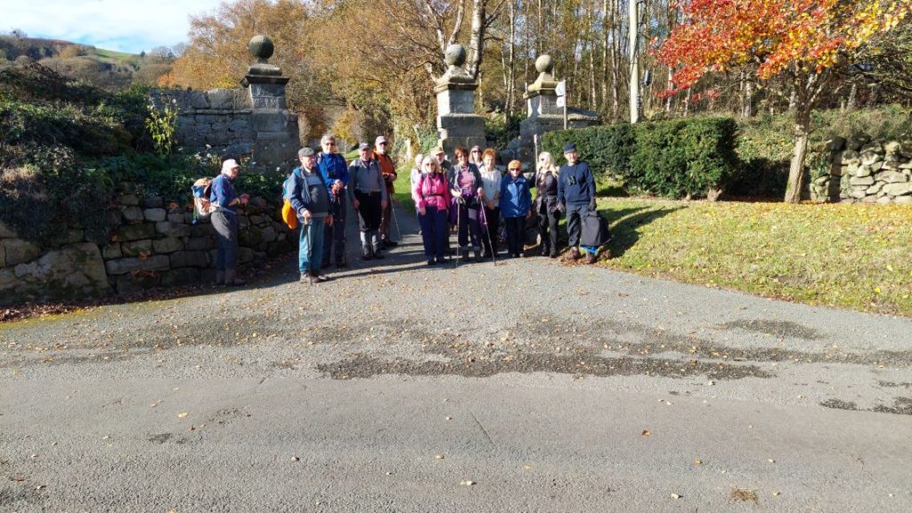
C Walk – 6 miles – Leaders Marilyn Norbury & Kath Conroy
This is a 6 mile circular walk starting at the Holly Bush pub.
We start walking south in the direction of Cymau where there is a steep climb but on a good road surface, making it fairly easy to achieve. We then head towards Caergwrle passing a small reservoir and on towards Bryn Ffynnon woods. We pass Bryn Yorkin Manor and go down into the town crossing an ancient packhorse bridge. After crossing the A550 the route becomes rural again and continues along Wat’s Dyke and the river Alyn back to the Holly Bush.

Uppermill 15 October 2024
A Walk – 12.8 miles – Leader Ian and Chris Thomson
This is a strenuous walk with a couple of steep climbs and extensive walking on exposed and sometimes muddy moorland. If the weather is good the walk offers magnificent views of distant Manchester and of beautiful moorland. However, if the weather is poor we have a back up, shorter, lowland walk around some of the reservoirs.
The walk starts near Uppermill Leisure Centre and we head off almost directly up towards the Pots and Pans stones, passing just below them. We then head up and over to Dovestone Reservoir and, after crossing the reservoir, we immediately start climbing again up to the moors. Once on the moors we initially head north walking high above the Yeoman Hay and Greenfield reservoirs. We then head off towards the Chew reservoir. The moorland paths are already fairly muddy in places and take longer to traverse than normal. Time (and energy) permitting we will take option 1 on the map which continues along the high moorland route. However, if we have insufficient time to get back to the bus we will take a slightly shorter and easier route back (option 2, 10.4 miles) descending quickly on the reservoir access road back towards Uppermill.
B Walk – 8 miles – Leader John Moreton
Our walk starts at the Leisure Centre with a strenuous climb up the valley side towards Saddleworth Moor. It continues around the hill offering views of Dovestones Reservoir. We descend and walk around the reservoir before starting a second climb up to a former tramway called the “Oldham Way” before returning along the river and canal leading into Uppermill’s main street hosting pubs, cafes and shops.
C Walk – 6 miles (Fairly easy with two stiles) – Leader Mike Martin
The Wrekin 29 September 2024

A Walk – 11.5 miles – Moderate – Leader Phil Mellor
Our walk uses the Shropshire Way to Little Wenlock then the Severn Way to Ironbridge before using the Shropshire Way returning to Little Wenlock.
We start our walk by using the main path to the top of the Wrekin passing the Half-way House. At the top we should get good views of the surrounding countryside. Now we walk down the steep slope to Neves Castle before using the country lane towards Little Wenlock then using a direct path we come to the river Severn. Walking by the side of the river towards the town of Ironbridge we come to the Gorge Museum (toilets available) then we make our way to the famous Iron Bridge which we will have time to admire. After a steep climb out of the town we get good views over the Gorge before dropping down to Coalbrookdale where we walk through the museum. After our visit to the museum, we return to the Huntsman pub at Little Wenlock.
B Walk – 9 miles – Leader Michael Taylor
Our walk starts and ends at the recently closed Buckatree Hall Hotel. An early climb up the Ercall precedes a woodland walk brought to an abrupt end at the M54. The Ercall is an internationally important geological site, part of The Wrekin and “The Ercall Site of Special Scientific Interest (SSSI)”. It’s managed by Shropshire Wildlife Trust and includes 540-million-year-old ripple beds and ancient pre-Cambrian lava flows in exposed quarries. Quartzite from the neighbouring Wrekin is also visible. The Ercall bears the marks of extensive quarrying, although the quarries are now disused, safe and open to the public. We join the Wrekin Forest Trail and start walking south through the Wrekin Golf Club, bordering Limekiln Wood until re-crossing the B5061. We continue through a more obscure part of the Wrekin Forest Trail until we reach Spout Lane Plantation. We turn right along a Permissive path to the foot of Little Hill. Here we start the first of two strenuous climbs first to Little Hill and then up to the Wrekin itself. A campfire setting atop of Little Hill provides a tranquil setting for a break and refreshment.
The vistas from the Wrekin are stunning on a clear day. The Wellington Arts Collective, a collection of Wellington and Telford based artists, designed and produced community inspired collection of work known as “The Sky Begins At My Feet” embedded into the trig-point. It was created using stoneware clay ‘relief tiles’ placed around each of the existing structures on the Wrekin to fit into the historic landscape. Further details are available at https://www.lordlieutenantofshropshire.org.uk/news/new-artwork-the-sky-begins-at-my-feet-for-all-to-see-at-the-top-of-the-wrekin/
By comparison, the descent is far less arduous and can be broken at “The Halfway House” if we arrive before their 4pm closing time. We meet the B5061, at the foot of the Wrekin for a third time, and a 300m walk along it’s one-way flank leads us back to the “closed” Buckatree Hall Hotel, where we pickup the coach and drive to the Huntsman in Little Wenlock for well earned refreshments.
C Walk – 5.6 miles – Leader Tony Whiffen
This is a mainly woodland walk, so plenty of shelter should the weather be against us, it has the opportunity to both lengthen, and shorten the distance.
Our walk starts where the coach parks and from there we make our way to the entrance of Ercall Wood, this well used path takes us past disused Quarries with seams of Wrekin Quartzite visible from the path, from the start of the walk we have a very gradual climb to higher ground so we will take it at a leisurely pace. Ercall wood is also a nature reserve so hopefully we may see something of interest on our first break? We leave the wood as it merges on the edge of the M54 motorway and after crossing a wooden bridge we enter Limekiln Wood, another ancient part of the Wrekin Forest which once formed part of a medieval Deer park of Wellington Hay. With luck we may see some of the many Fallow Deer roaming the woods (at least a dozen seen on the recce). From Limekiln wood we cross open ground to Wenlock’s Wood, before crossing to skirt the Wrekin on its lower level back to the coach park.
Because of the terrain the walk seams longer than its 5.6 miles and can be a bit rough under foot, as well as but only one stile.
Longnor 15 September 2024
This was our anual Meal Walk.
A Walk – 10.5 miles – Moderate/Tough (Chrome Hill) – Leader Phil Mellor
We start by walking along the lane opposite the church before joining paths across fields to Underhill Farm. After a short walk along the road, we turn off to cross over the River Dove before we start to climb up to Chrome Hill. At the top we enjoy great views over the impressive Staffordshire countryside which must have been formed during the Ice Age. We must take our time coming down as the limestone is slippery with many interesting features to traverse around. Now we walk around Hollins Hill using the bridleway which passes Frough on our way to Hollinsclough. Using another bridleway and lanes we join the Manifold Circular Way to Hole Carr farm. Hopefully before we drop down the valley to the farm we see the usual cows but a herd of deer, donkeys and alpaca were a surprise on the recce. Unfortunately, we must walk through a short stretch of gorse where the use of shorts may be a problem on bare legs. At Marnshaw Head we join a lane that takes us to the road for a short stretch before we turn off to Fawside and our return in time for our meal at Longnor.
B Walk – 7 miles – Leader Ruth Beach
Our walk is shorter than usual as we have to be back a Longnor for our meal at 4pm.
We start by descending down to the river Dove which we follow for the first part of the walk. We go through the hamlet of Crowdicote and along the valley to Pilsbury stopping shortly to see the remains of the castle. We then ascend up towards Sheen Hill. If time allows, we could use the permissive path up to Sheen Hill which is a lovely view point. Those that do not want to go up could stop for a longer lunch break.
The way we descend down to the Manifold Way will depend on time and weather. There is also a problem with a bridge over a steam, which has been reported and may be mended by Sunday so giving a more interesting route.
We then follow the Manifold Way back to Longnor. There are quite a number of stiles and gates, with at least one squeeze stile.
C Walk – 4.6 miles – Leaders Marilyn Norbury & Kath Conroy
This is quite a short walk but does involve a couple of steep climbs, which in this countryside it’s impossible to bypass. We will obviously take it slowly so it should be possible for everyone to enjoy.
We walk north out of the village and drop down to Beggars Bridge towards Green Lane. We then proceed west to Glutton Bridge and continue on a steady flat part of the walk at the foot of Park House hill. We climb up the lower part of the hill and continue to the village of Earl Sterndale. It is easy walking again then back to Green Lane and Beggars Bridge. Then our final ascent is retracing our steps back up the hill which we walked down in the morning. Returning then back to Longnor and the Old Cheshire Cheese where our meal awaits us.
Church Stretton 1 September 2024
A Walk – 12 miles – Moderate – Leader Yvonne Mason
We start by walking through the town [toilets available] to Carding Mill Valley which is a National Trust area with a visitors centre, café and toilets. Onwards gaining height as the valley tightens we then turn off to Light Spout Hollow and hopefully we will have our first break at the waterfall. At the top we cross over the moors of the Long Mynd to achieve a height of approx. 480 meters, hopefully if the weather is right for flying we may see gliders above us as the flying club is not far away. Now we come down to Coats Farm to join the Shropshire Way. On the way we pass the village of Bridges which is a magnet for walkers and day trippers. Next we cross Darnford Brook to pass through Ratlinghope village before using minor lanes and paths to cross back over the Long Mynd. Dropping down we make our way towards All Stretton and finish by walking through Cwm Dale and the impressive houses before returning to the town.
B Walk – 9 miles – Leader Mike Leydon
After being dropped off in the car park close to the railway station, we head into the town where there are toilets.
We then walk through mainly woodland down to the village of Little Stretton.
Our route out of the village is a steady, but not steep, climb with Callow to our left and Nills to our right. There are great views behind us on this section of the walk. This leads us onto the plateau looking across to Long Synalds.
A short stretch of walking on a minor road takes us past Pole Bank and Shooting Box. We turn onto Jack Mytton Way and start the downhill route toward Carding Mill Valley and back into Church Stretton, where there are cafes and pubs.
C Walk – Leader Bryan Clydesdale
Our walk starts by the Railway Station in Church Stretton followed by a stop at the free toilets.
We then walk out of Church Stretton and along the Madeira Way heading for Nover’s Hill which we shall walk around.
We then walk on to All Stretton and from here we are walking across fields to cross the railway and the main road.
We then continue towards Helmeth Hill which we will also walk around. Then then we drop down to the village of Hazler. From here we walk back to Church Stretton skirting Hazler Hill, through the woods and passing Snatchfield Farm.
There will be time for refreshments at the many pubs and coffee bars in Church Stretton before the journey home.
Loggerheads 18 August 2024
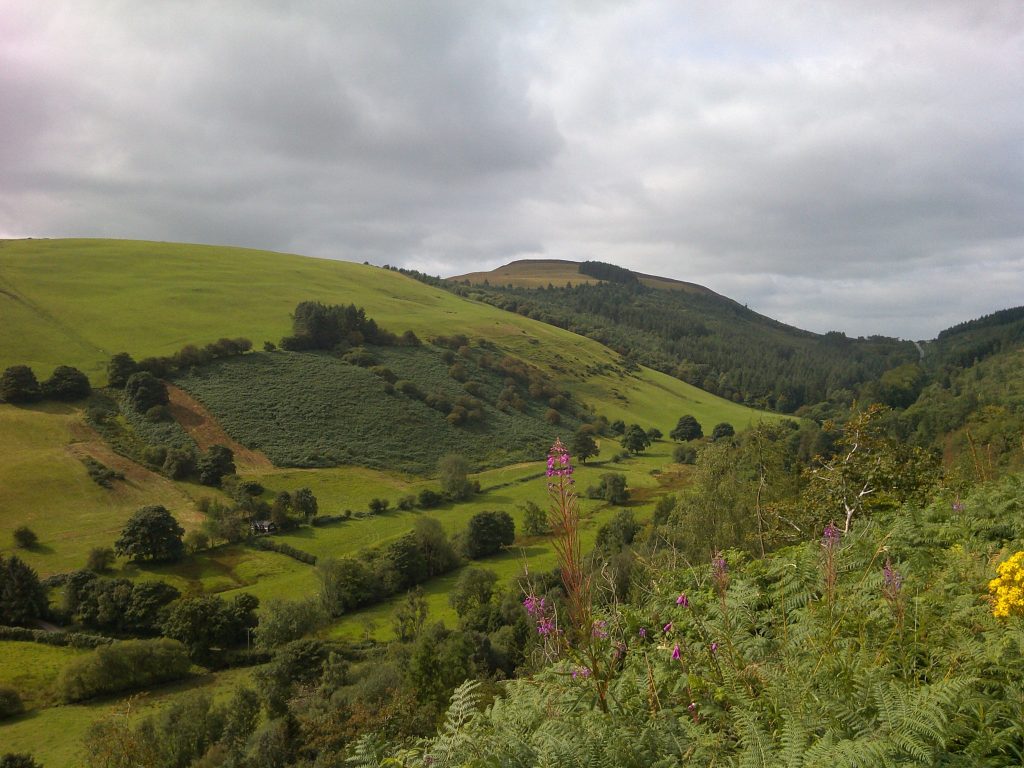
Details of the three walks offered were:
A Walk – Moderate/Tough – 12 miles – Leader Phil Mellor
A different way to walk to Moel Famau – I was hoping to achieve an easier way to the top but my conclusion – there is no easy way .
We start by walking out of the Country Park to the village of Maeshafn where we see our objective in the distance [Moel Famau]. Walking through the forest paths we make quick progress to cross the A494 to pick up the main path to Moel Farmau. Gaining height we join the Offa’s Dyke Path, we may recognise this point as we used this for our previous Ruthin Walk. Stopping for lunch we are spoiled by looking over the stunning vale of Ruthin surrounded by the purple heather and views to Snowdon and Llangollen. At the main car park we start the final climb to the Jubilee Tower at the top of Moel Famau and reaching the top we can congratulate ourselves we have achieved our goal of 554 meters from sea level. Depending on time and weather we will decide which of the two paths we will choose to descend back to the Country Park.
B Walk – Loggerheads to Moel Famau Circular – 9 miles – Leader Esther Williams
From Loggerheads Country Park Visitor Centre (where there are toilets), we take the lane out of the park and follow the stream, Aber Eilun, alongside a wooded hill towards Clwyd Forest. A winding path brings us out onto the main track leading to Moel Famau and already the views begin to open up to this designated Area of Outstanding Natural Beauty.
After a break at the popular picnic area of Moel Famau Car Park (where there are further toilets) we begin our climb to the summit. At 554m, surrounded by Iron-Age hillforts, Moel Famau is the highest hill in the Clwydian Range but we will take one of the easier routes to the summit joining the Offa’s Dyke Path. The 360 degree far reaching panoramic views at the top make the climb worthwhile (weather permitting).
From the Jubilee Tower we continue with Offa’s Dyke Path initially and enjoy a gradual descent along bridleways, footpaths and through woodland, following the River Alyn back to Loggerheads.
This is a moderate walk with good paths that gradually ascend but there are some sections which are steeper as we approach the summit, and some of the paths are topped with loose stones. Walking poles are recommended for hill walking.
C Walk – 5.5 miles + time to explore Loggerheads Country Park – Leader Ruth Beach
The walk explores the area round the attractive village of Maeshafn. It is quite an undulating walk with some lovely viewpoints. We will take our time with lots of stops. There are options to shorten the walk if needed.
Ramsbottom 4th August 2024
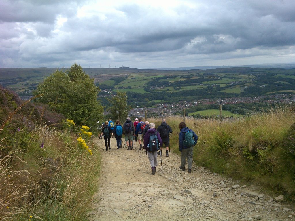
Details of the three walks offered were:
Walk “A” – Moderate – 12 miles – Leader Phil Mellor
We start by walking up through the town to Holcombe where we join the path to Peel Tower then over the moors across Harcles & White Hill to the Pilgrims Stone Monument which replaced a cross, then walking alongside the military firing range we drop down to the mill village of Stubbings. Now we join the Irwell Riverside Walk which runs parallel to the East Lancs Heritage Railway line and through the gardens of houses of Upper Ramsbottom. Crossing the river & the M66 we join the Rossendale Way [RW]. Leaving the RW we make our way over Scout Moor to Whittle Pike Cross and the many Wind Turbines [hopefully we will get clear views to Winter Hill to the West and Wernside to the North]. Dropping down we now join the RW to the village of Shuttleworth and alongside the Quarry which will take us back over the M66 and into Ramsbottom.
Walk “B” – 9 miles – Leader Bryan Clydesdale
We start the walk in the centre of Ramsbottom and have a short walk out of the town to the village of Carr. From here we follow footpaths through Top Wood and Ox Hey Wood to the village of Stubbins. From Stubbins we follow the Rossendale Way through more woodlands.
Then crossing a B Road we start the climb up towards Beetle Hill. Turning South we walk over Holcombe Moor with views over Ramsbottom and its surroundings. We pass the Pilgrims Cross (Stone) on our route to the Peel Tower. Built in 1852 this well known Bury landmark was erected in tribute to one of Bury’s most famous sons, Sir Robert Peel; founder of the Police force and Prime Minister 1841-1846. The tower stands 128ft high and offers stunning views over Manchester and North Wales.
From the tower we drop down to Holcombe and then follow the old cobbled Holcombe road round Hazelhurst. Crossing the main road we are back on footpaths through woodlands to Brooksbottom. We continue on footpaths around Nuttall Park till we reach the main road again which takes us back into the centre of Ramsbottom where there are pubs and coffee bars.
Walk “C” – Mostly Easy – 5.5 miles – Leader Mike Martin
We start in Ramsbottom (toilets available at a nearby services) and walk through the town to cross the East Lancs Railway at the station. We turn into an industrial area to reach fields for a pleasant walk alongside the River Irwell which keeps us company for most of the day. (A coffee break will be taken at a suitable place on this section). We cross a bridge and find that we are “Welcome to Stubbins” and pass through gardens alongside the river to Strongstrey. Here we go under two railway bridges. The first is the East Lancs Railway and the second is the closed line from Stubbins to Accrington. We turn onto this which is now a cycle path so care will be needed. Just before reaching Lumb Viaduct, we turn off on a path leading towards Irwell Vale. There is a good place for lunch along this path. After lunch we take the path under the East Lancs Railway and follow this through the attractive village of Chatterton to the bridge at Stubbins to rejoin our outward route. In Ramsbottom Pubs and Cafes are available to suit all tastes.
Bridgnorth 21st July 2024
Details of the three walks offered were:
Walk “A” – Moderate – 12.5 miles – Leader Phil Mellor
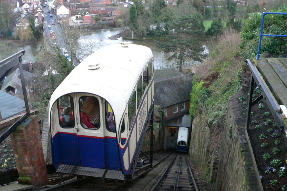
We start by walking through the historic town of Bridgnorth [great views over the River Severn] to the ruins of the Castle which looks over the Severn Valley railway station. We then descend to the railway station where we have toilets. Leaving the station, we walk around the back of the engine sheds to walk to the village of Oldbury. Now passing over fields we eventually have to walk along the B4363 to join the Jack Milton Way [this is necessary as a Foot Bridge has been closed on our chosen route]. Now we pass through the village of Chelmarsh and then onto Chelmarsh Reservoir before lunching at Hampton Load railway station [toilets and shop available]. Using the Severn Way, we walk by the side of the river passing through fields of wild flowers before reaching the lower town. At this point we have the option of using the road, steep path or the Funicular railway to the upper town and back through the historic town to the coach.
Walk “B” – 8 miles – Leader John Moreton
Starting from Bridgnorth, with its many shops, cafes, pubs and a castle on 2 levels we walk down Main Street towards the lower part of town before following the River Severn though a few fields to the Severn Valley Railway. The walk continues across the Shropshire countryside through many kissing gates but only 2 styles before returning through the railway station to a welcome Weatherspoons.
Walk “C” – Easy – 5.7 miles – Leader Tony Whiffen
The walk starts from the coach park in High Town Bridgnorth. After a 10 minute walk through the upper town we will stop at the public toilets off Listley Street, from there we continue through the town descending towards the River Severn. Before we reach the river we have two stops of interest, firstly the Castle Grounds with impressive gardens set around the ancient ruins of the Castle. Here there are viewing points overlooking the lower town and the river, secondly we have a brief stop at the Severn Valley Railway station, were we may have an opportunity to see a steam train and view this nostalgic period station of a bygone age. From here we road walk for a while before entering a kissing gate and crossing to meet the river path, we continue for a short stretch until we come to the road bridge crossing the river, an opportunity here to stop for our first break as there are benches on the quayside. From here we cross the road and after passing the remains of a Franciscan Friary eventually pick up the Severn Way continuing on our river walk alongside a golf course, on leaving the river walk we head up across a field cross over a disused railway line and head back into High town along a track onto roads that take us back to the Coach park. A lunch break could be taken at one of the breaks between the golf course and the Severn Way.
Carsington 7th July 2024
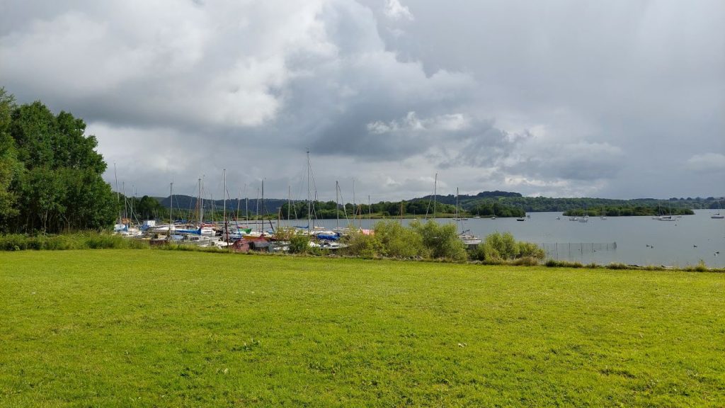
Details of the three walks offered were:
Walk “A” – Moderate – 12.5 miles – Leader Phil Mellor
We start by walking from the visitors centre to walk across fields, hopefully we will see the large variety of wild flowers that Derbyshire is famous for. On our way around the walk we pass the following picturesque villages :- Hognaston, Kniverton, Parwich (toilets available), Ballidon, Brassington and Carsington. Now we return to the visitor centre we walk along the side of the reservoir, with bird hides and water sport activities this is a very popular attraction.
Walk “B” – 8.5 miles – Leader Tony Green
Starting from Carsington Water visitors centre, this walk takes us around the reservoir and along forest paths into the village of Hopton and Carsington, before returning to the start. It is a very steady walk with one small climb.
Walk “C” – 6 miles – Leader John Moreton
A nice easy 6 mile walk from the visitor centre with shops, cafe and toilets. Taking in part of the lake with many activities. Towards the picturesque village of Carsington and the Miners Arms pub. Continuing through Hopton past the hall and returning with the option of an ice cream.
Malham: 23rd June 2024
Details of the three walks offered were:
Walk “A” 10/13 miles – Moderate – Phil Mellor
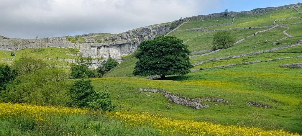
We start by walking through the village on the Pennine Way to the impressive limestone cliff of the cove and see the stream emerging from the foot of the cliff which has travelled underground from the Tarn. Now climbing up the left hand side of the cove we reach the top which is covered by the Limestone Pavement which is difficult to walk over [Clints are the tops and Grykes are the gaps]. Continuing on the Pennine Way we follow the dry river bed to Malham Tarn where water starts to flow before vanishing into the Limestone. Walking around the Tarn we see the benefits of the National Trust grounds and at the Malham Tarn House we have a visitors centre and toilets. Leaving the Pennine Way we walk back to the village using paths and lanes which gives us good views over the moors and limestone features. With the limitations of paths and distance I have chosen to return to the village where we should have the time to extend our walk by visiting Gordale Scar [ this will extend or walk distance to 13 miles but if the weather is poor or walkers wish to remain in the village the walk will be 10 miles long].
Walk “B” 8.5 miles – Moderate – Michael Taylor
The first couple of miles follows well-manicured tourist path from Malham, out via Janet’s Foss Waterfall to the “brew wagon” at Gordale Bridge. Whilst serving a steaming cup of Yorkshire Tea, the “brew wagon” was the meeting point for walkers who choose to visit Gordale Scar. Unfortunately, it was very popular with ice cream loving members willing to queue on a warm sunny day; our overdue stay compromised timings resulting in a deviation back to Malham Cove.
Suitably refreshed, the walk branches North West along the path towards Malham Cove, before we hit the base of the day’s only real climb. A permissive path leads up to “New Close Knots” and follows the scar until it rejoins the original scar footpath. The path continues northbound towards Street Gate where we pickup the day’s single stretch of tarmac used to cross to the starting point of our descent.
We cross through numerous areas of “shake holes” otherwise known as “sink holes” outside of Yorkshire. As the limestone rock dissolves, spaces and caverns develop underground. If there is insufficient support for the land above the spaces, then it collapses. In areas of soil or boulder clay coverage the material is washed into the cracks or fissures below causing the land to slump.
Having reached our closest point to Malham Tarn, our path returns to the fells and heads toward Langscar Gate; however, the walk followed a simpler return down Trougate. Our elevated position to the east of the Limestone Pavement provided wonderful view of the pavement in the afternoon sunshine.
Crossing the pavement was only hampered by members keen to be photographed at the edge of 230-foot high Malham Cove. A kissing gate marks the start of a 400 stone stepped decent into Malham Cove, where a short stop follows to enjoy the magnificent view of the cove.
The route finally steps back onto tarmac and joins Cove Road and tree lined permissive path to through to the Lister Arms for well earned beverages.
Walk “C” – Marilyn Norbury and Kath Conroy
We are calling this a walk of two halves with an optional extension. That’s exactly what we have come up with after our recce.
We decided to avoid parts of this stunning area which would be quite challenging for C Walkers and so we are offering a figure of eight. . We visit Malham Cove & Janet’s Foss with an option of viewing Gordale Scar. All three of these are the key places people go to see when visiting the area.
We start in the village and return there briefly to pick up the path allowing us visit the Foss and on to the Scar if people wish. The first part of the walk is 2.5 miles, followed by 3 miles and a further mile out and back to see the waterfall at Gordale Scar.
The walk is suitable for all abilities Group C and below!! People can pick and choose. We are therefore hoping some people will join us who would normally find the C walk a bit longer than they would like. There is a cafe in the village and two pubs for people to while a little time away if not doing all the parts of the walk.
Llandudno: Sunday 9th June 2024
Walk “A” 12 miles – Phil Mellor
We start our walk from the Little Orme using the Welsh Costal Path (WCP), this does not take us to the top but takes us down to the Quarry where we may see the seals in the bay. Turning off the WCP we make our way inland to pass St. Davids College and on to Llanrhos where we pass St. Mary’s Well. Now we climb to the remains of Degannmy Castle which gives us stunning views over Deganwy and the Conwy Estuary. Dropping down we again join the WCP allong the West side of Llandudno before we start to climb up Great Orme at the Marine Drive gate house (this is a very interesting path and looks down onto the Marine Drive). At the top of the Great Orme we follow the Tram Line down into the town passing the Bronze Age Workings which now has a visitors centre. Now back to the coach but hopefully we will have time to visit Weatherspoons which has been sympathetically converted
from the old Cinema.
Walk “B” 9 miles – Esther Williams
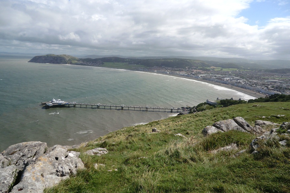
The walk is moderately strenuous and explores The Great Orme. The ascent is fairly steep following a route up through Happy Valley Gardens but the views over the bay to The Little Orme and beyond are well worth the effort. Equally the return towards the west shore affords wonderful views of the Conwy Estuary, weather permitting. The walk takes in natural features formed during the last Ice Age including distinctive limestone rocks; those associated with folklore, such as the well ‘Ffynnon Powell’; manmade structures including St Tudno’s 12th century Church, and the Visitor Centre where there are toilets.
Walk “C” 5 miles – Bill Pearson
A bit of a climb near the start, but generally on good paths and no styles. We walk along the North Beach (passing the coach park where our coach will pick us up) to the pier and then ascend, admiring the views to Happy Valley. At Happy Valley there are free toilets, and an opportunity to reward yourself at Parisellas Ice Cream Parlour, whilst admiring the Stone Circle and Botanical Gardens.
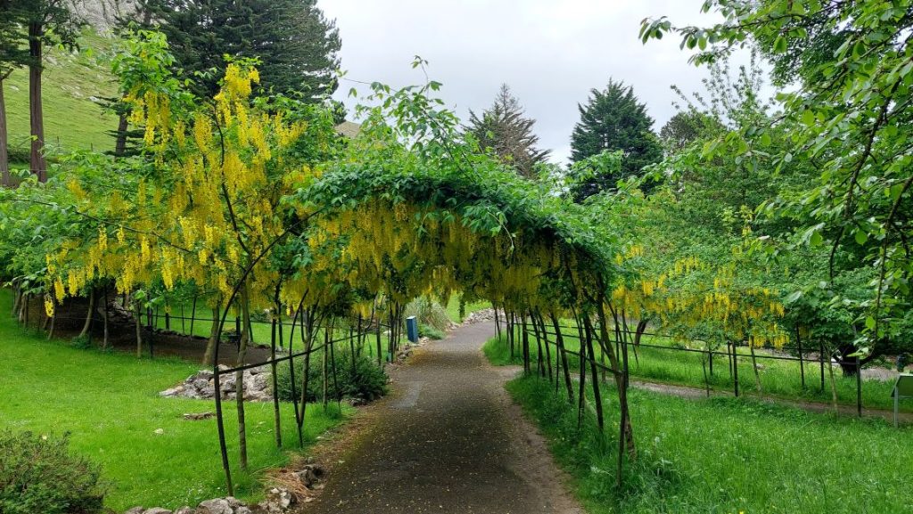
Having explored Happy Valley, we pass the Camera Obscure and walk along Hill Terrace. We then pass the Tram Station, and later Dum and Dee, and go to Haulfre Gardens, where there are free toilets, a café and lots of seats.
We then proceed via Lover’s Walk to the West Shore. There are toilets at the West Shore which cost 50p. We can then return through the town, admiring more Alice in Wonderland statues. For those wishing to do more miles, you can walk to the end of the pier.
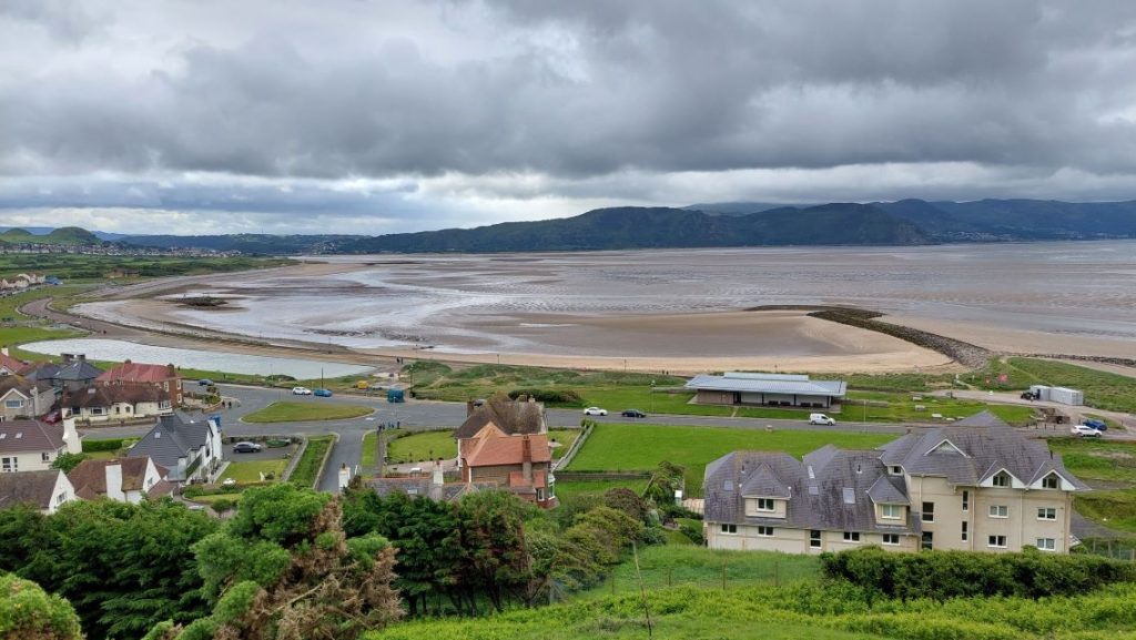
Hathersage (Derbyshire): Sunday 26th May 2024
Walk “A” 12 miles – Moderate – Marlene Flannery
We leave Hathersage & climb steadily towards Stanage Edge, first taking a footpath up to the church where, time permitting, we can visit the grave of Little John (outlaw & friend of Robin Hood!)
Shortly afterwards we walk past North Lees Hall which reputedly was the inspiration for Thornfield Hall in Charlotte Bronte’s book “Jane Eyre”. We then climb up to Stanage Edge, picking our way amongst the rocks at its base. Scattered amongst the heather & bracken you might be lucky enough to see part-finished millstones which were once produced in the area for the steel industry in Sheffield.
On the top of the Edge, we walk towards Burbage Moor, following the track, then a stream, until we reach “Toad’s Mouth”, another rocky outcrop overlooking the main road from Sheffield.
We continue our way beside the stream and woods through part of the Longshaw estate on our way back to Hathersage, arriving in Upper Padley. Here is Padley Chapel, a secret place of worship for catholic families during the Reformation. Much renovation has been done in recent years & it is open to the public between 2-4pm each Sunday from April to Autumn.
From here, we continue to follow the river Derwent until reaching the outskirts of Hathersage.
Our last point of interest is the David Mellor Museum, Craft Centre & small cutlery factory. David Mellor was a renowned cutlery designer, brought up in Sheffield, & whose skills have been acknowledged worldwide.
Walk “B” 8.5 miles – Fairly Strenuous – Esther Williams
From Hathersage we begin a very gradual climb through fields and woodland up onto Stanage Edge. This marks the boundary between Yorkshire and Derbyshire with impressive cliffs and good views over the surrounding area (weather permitting). On way down there is an opportunity, depending on time and energy, to take in Higger Tor with equally impressive views. From Higger Tor we continue back to Hathersage via St Michael’s Church with a chance to visit Little John’s grave, part of the Robin Hood legend. The church is also associated with Charlotte Bronte who stayed at the vicarage in 1845 and drew inspiration for her novel ‘Jane Eyre’ from the surrounding area. Stained glass windows featuring the real Eyre family can also be found in the church along with family graves. The walk ends back in the village.
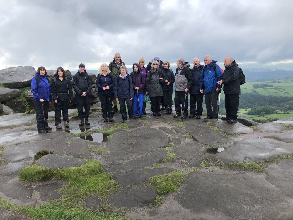
There are good tracks and lanes for the most part with only a couple of stiles. The path along “The Edge” however, is not always straight or flat, it meanders around large outcrops of rock and involves stepping across stone pavements in some places. The stones are flat and it is not difficult but does involve a degree of stepping up and down.
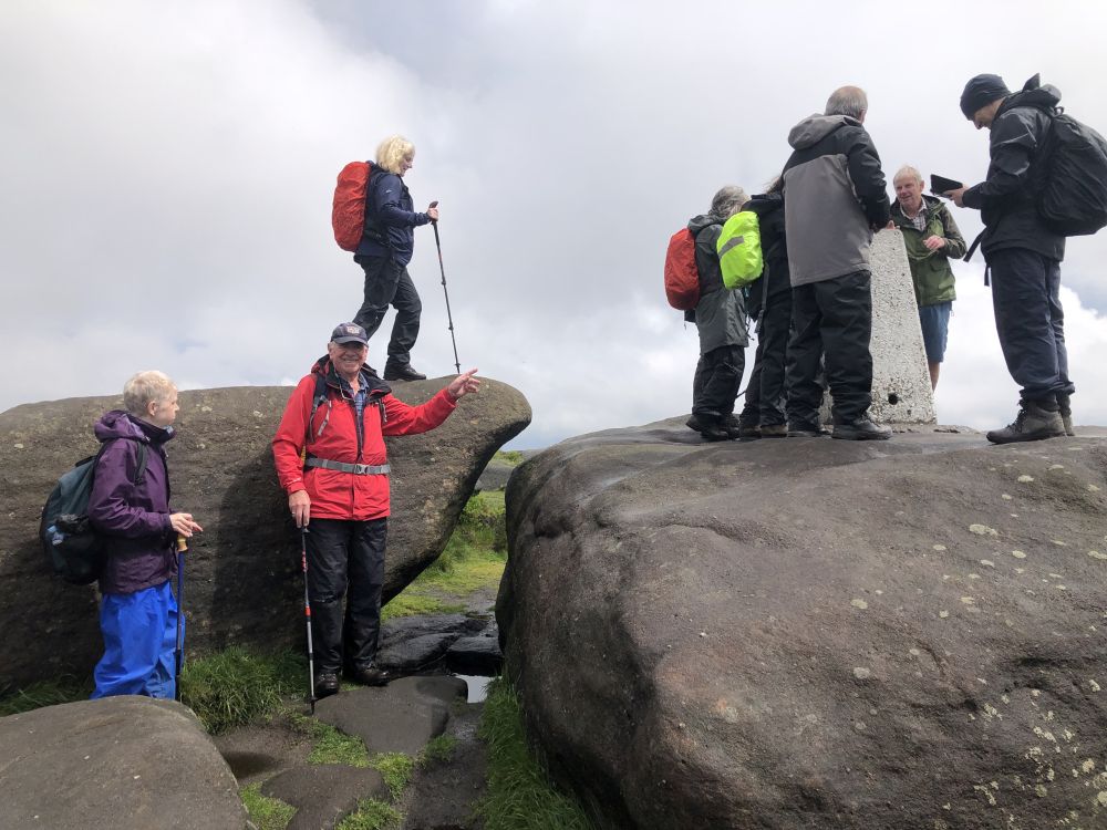
Walk “C” 6.5 miles – Easy with gentle climbs – Maurice Drake & Tony Whiffen
We first walk about 300 yards to toilets in Main street. We start walking less than a mile southward, crossing the railway and later arriving at Leadmill Bridge over River Derwent. We then walk 2.5 miles along Derwent Valley Heritage Way on south side of attractive wide river to Shatton in Hope Valley. Hopefully, we’ll see two colourful mandarin ducks first spotted on the ‘reccy’. About halfway we come to the many large stepping stones across the river and we were surprised to see an energetic young man run across to the other side; not for the faint-hearted!
After Shatton we cross the railway and soon go eastwards on the path which crosses the river again and come to the busy A6013 (Station Road) which we follow for about 400 yds. We turn off along Saltergate Lane and soon get on to the large golf course. We skirt around the immaculate grass, but the path is poorly signposted (the golfers could not guide us) ; look out for flying golf balls. We soon come to Thorpe Farm (a previous report said they make ice cream) and start a gradual climb from here up to Birley Farm. From here it is a steady descent southward through woods for about ½ mile back to coach park.
Welshpool: 12th May 2024
Walk “A” 12 miles – Phil Mellor
We start by being dropped off at the Offa’s Industrial Estate just before the town of Welshpool. Starting to walk the Offa’s Dyke Path we climb to 408M at the Beacon Ring Settlement [we will take our time in walking up and have our first break overlooking the Seven Valley].
At the Beacon we see the remains of the Hill Fort which is pre bronze age and now planted with trees to form ER in the foliage at certain times of the year to celebrate the Queen’s Coronation. Now we continue down to pass through Leighton Park which is set in a valley with reservoirs and water features before we pass the Manor buildings and view the Vernicular slope that was used to connect the Lodge to the Manor. Now we pass the extensive Farm buildings which were originally used for intensive farming but are now used for stud farming with a helicopter pad which shows the money in keeping race horses.
We now cross the River Severn on the Forden road and cross over the Welshpool Airport Runway to join the canal. The Welshpool Canal is in water at this point and is used for boaters as a tourist attraction and forms a wildlife corridor all the way to Newtown [hopefully Welshpool will be connected to the main canal system one day as progress is being made to renovate the disused section from Llanymynech]. Leaving the canal we continue to walk through the grounds of Powis Castle and if we are lucky we may see deer and hopefully if we have time we may be able to walk up to the Castle entrance before we walk back into the town and the coach.
Walk “B” 9.5 miles – Bryan Clydesdale
The walk starts in the main car park in Welshpool. We start the walk passing through the town until we reach the Light Railway Station. We then join the Glynwdr’s Way and start the climb up the driveway to Llanerchydol Hall passing the Hall Lodge.
We continue along the Way passing through Wern Wood and passing Y Golfa which is the highest point of our walk. Now we walk through the Welshpool Golf Course.
Leaving the golf course we drop down to Sylfaen Halt on the Light Railway. We cross the Light Railway and head across fields to Ty’n -y-pwll where we turn for home.
We now have a long walk climbing up Cwm Lane. Leaving the lane we are now walking across fields with lots of sheep and lambs to Talyrnau Farm. We continue along a lane overlooking the Light Railway.
Leaving this lane we are now back on fields following the Nant -y-caws Brook. This takes us back to the Light Railway Station and a short walk back into town.
Some footpaths have not been used for some time and are somewhat overgrown.
Walk “C” 5 miles – Ruth Beach
Whilst quite short at 5 miles, please bring your National Trust membership card with you if you are a member as there will be time to spend at Powes Castle. Even if you are not a member there is plenty to see as we are able to go right into the courtyard and have lovely views over the gardens.
From the car park our first stop will be Morrisons where there are toilets. We then follow the Montgomery Canal, which is a very attractive water course. At Belan locks we will stop for a good break and then decide our plans for the day. We could go up towards the castle or explore further along the canal. I had looked at other possibilities, but we would find ourselves crossing and re crossing busy main roads.
Ashbourne: Sunday 28th April 2024
Thirty Nine members joined our three walks based at Ashbourne. BBC Weather predictions were pretty much fulfilled; after a damp start, the sun broke through clouded skies unveiling a very pleasant afternoon’s walking.
Walk “A” 12 miles – Phil Mellor
We start by joining the Tissington Trail before turning off to the village of Mappleton and then down to the mill where we see power being generated by the Archimedes screw. Now we walk over estate grounds of Okeover Hall which gives us good views of the Hall and when we reach the top good views over the Dove Valley. If we are very lucky deer can sometimes be seen as we approach Woodhouses and Bloor. Dropping down into Ilam we cross over the river Manifold to walk up to Ilam Tops. Then walking along the top of the Dove Valley we get impressive views of the limestone rocks that tower above to the river below. Now a steep walk down into Dove Dale to walk down stream to the stepping stones before we turn off to go to the picturesque village of Thorpe. Again, we walk up to get good views as we walk back to join the Tissington Trail and back to the coach.
Walk “B” 9.5 miles – Mike Laydon
Coach drops off adjacent to the Ashbourne Leisure Centre.

Cutting through the grounds of St. Oswald’s Church, we join Mayfield Road – our route out of Ashbourne. After crossing the A52 we enter potentially muddy fields and follow Henmore Brook towards Clifton. Crossing over river Dove we enter the village of Church Mayfield. The industrial buildings belong to Mayfield Yarns, the leading supplier of warped and twisted yarns in Europe. Passing on through Middle Hayfield (there are a lot of Hayfields in this area!) we head up onto the Limestone Way. After recrossing the A52, we head downwards past the impressive Okeover Hall and on to the village of Mapleton. An uphill stretch takes us through Callow Top campsite and finally onto the Tissington Trail back into Ashbourne where there are cafes and pubs.
Walk “C” 5 miles – Tony Whiffen
At the coach park we have limited toilet facilities in the adjacent leisure centre. From there we have a short walk along School Lane to St Oswald’s Church, and on crossing the road we start our walk next to the school taking a footpath up onto the higher ground. We continue on a short accent before dropping down to meet the River Dove, and make our way along the river where we will have our first break at a convenient point before heading to Oakeover Bridge. Here we leave it and cross the field to the village of Mapleton with the ‘Oakeover Arms’ and the tiny church of St Mary’s directly in front of us. Our lunch stop could possibly be taken in the grounds of the pub or before that at the bridge area. Just after the pub we take the footpath up to the higher ground where there are splendid views across the river and valley. After a short walk across fields we continue through a caravan site with its own pub the ‘Callow Inn’ before a short road walk which takes us to a footpath leading to the Tissington Trail. We head back into Ashbourne on the trail arriving at the Cycle hire centre (where there are toilets). From here there is some up hill road walking before we drop down into Ashbourne high street and back to the coach park.
Frodsham “Overton Hill” and Helsby Hill Car Walk- Sunday 14th April
The 8 mile walk led by Michael Taylor was based on a walk published in “Country Walking Magazine” yielding extensive views over the Mersey Estuary, Liverpool, North Wales and our own Beeston, Peckforton and Bulkeley Hills.
A select group of walkers met next to the Beacon Hill Radio Mast well before the planned start time in anticipation of a rain-free day’s walk. It began by contouring around Overton Hill taking in Frodsham Hill Wood and the Overton Hill Memorial to the fallen in the Great War. Good progress delayed our coffee break and the walk continued along the edge of Dunsdale Hollow and Woodhouse Hill before descending steeply (mostly stepped) down to Tarvin Toad.

Whilst crossing to Helsby Hill, the walk encounters the wettest pasture of the day. Accomplishment of a challenging climb allowed us to take an early lunch atop of Helsby Hill. Fortunately, excellent weather contributed to the extensive 360 degree vistas from the trig point.
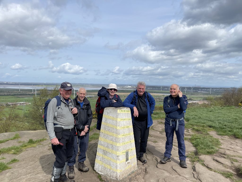
The decent picked up the Longster Trail and the North Cheshire Way towards Alvanley; however, before veering west along Commonside before picking up the Sandstone Trail. The trail climbs gradually through Snidley Moor before trekking east to meet up with Manley Road. After a short walk up Manley Road, the route veers north across pasture land back towards Beacon hill.
An early finish was celebrated with refreshments in the Ring O’Bells in Frodsham.
Tideswell (Derbyshire): Sunday 31st March 2024
Julie Shaw led the 12 mile moderate A Walk.
We start our walk by passing the church to use the quiet country lane to Wheston and Dale Head which gives us good views over the countryside. At Dale Head we join the Limestone Way to walk down Peter Dale then leaving the LSW we continue along Monks Dale to Miller’s Dale. [Monks Dale is deep and covered with trees which enables moss to cover the trees and limestone – a special note must be made as care is needed as the slippery terrain makes walking difficult, but we will take our time to aid concentration].
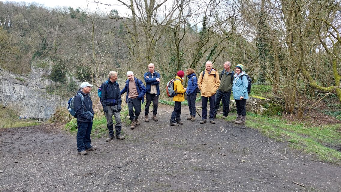
We will most probably have lunch at Millers Dale as we have toilets and a cafe. Now we walk along a short stretch of the Monsal Trail before turning off to drop down to Litton Mill and then along the River Wye to Cressbrook. After a short walk along a lane, we enter Cressbrook Dale, then at the top of the Dale we turn off to walk along Tansley Dale to the village of Litton. Again, we use the country lanes to return to Tideswell which gives us good views over the Dale tops.
Bryan Clydesdale led the 9.5 mile B Walk.
The walk starts in the village of Tideswell. We leave the village passing the George Inn pub and the Fish and Chip shop and walk down Slancote Lane where we pick up a footpath which takes us across fields and several rockwall stiles to join the Limestone Way which overlooks the Monks Dale.
We follow the Limestone Way which is very muddy in parts until we drop down to join Meadows Lane. Now we have some road walking on the narrow road sidewalk so care must be taken.
The road takes us to the Millers Dale Station where there are toilets. Here we join the Monsal Trail. We will follow the Monsal Trail until we reach the Litton Mill. This old mill has now been converted into a luxury apartment complex. Here we leave the Monsal Trail and cross the River Wye. We now follow tracks alongside the River Wye to Cressbrook. These tracks are very muddy in parts.
Here we pass through another development to join the road and start a long steady climb up the Cressbrook Dale. Initially we are on tarmac but shortly we are back on rocky paths. Some parts of the track are quite difficult so take care.
Eventually we reach a footbridge crossing the stream and enter the Tansley Dale where we have a short steep climb out of the dale to fields. Crossing these fields leads us to Litton village where we will follow the road back to Tideswell.
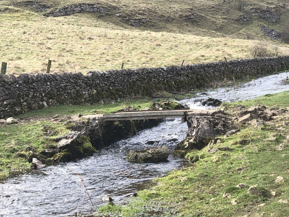
Marilyn Norbury and Kath Conroy led the 6 mile C Walk.
A nice steady 6 mile walk with some stunning views with 2 short climbs. From the town we head down Tideswell Dale towards Millers Dale for our first coffee break. Crossing the river and climbing up to the Monsal Trail for a stretch before dropping down across the river and leaving Millers Dale to join the Limestone Way for lunch. Our post lunch walk takes us back across a few fields back to Tideswell.
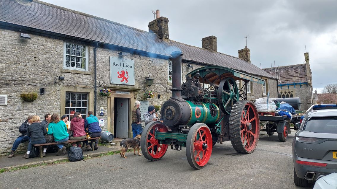
Holywell: Sunday 17 March 2024
The A Walk was led by Yvonne Mason.
We start our walk by joining the Wat’s Dyke Way towards Halkyn using country lanes, across fields and wooded valleys. We pass very close to the actual Dyke which was dug as a boundary to Wales and predates Offa’s Dyke. At Halkyn we climb up to open land where sheep roam freely and soon becomes apparent the Mountain has been heavily mined with many caped shafts and large quarries which are in operation today. At Rhes-y-cae we turn towards the coast and up to the trig point which gives us good views of the Dee Estuary. Next, we walk through the Bryn Mawr Quarry where we will see the Limestone Kilns before we walk over Holywell Common to Brynford. Climbing up again to our second Trig point [255M] and yet again we get good views out over the estuary. Walking down back to Holywell we join the Pilgrim Way to St Winifred’s Chapel where we may have the chance to visit the Shrine, then just a short walk into the town takes us back to the coach.
The B Walk was led by John Moreton.
From the town and toilets after a short walk we reach St Winifredes Well, the main attraction in Holywell and the origin of its name. Then across fields, and tracks, through a golf course with views of the sea dropping down to the coastal path and the former funship and Greenfield Sunday Market.
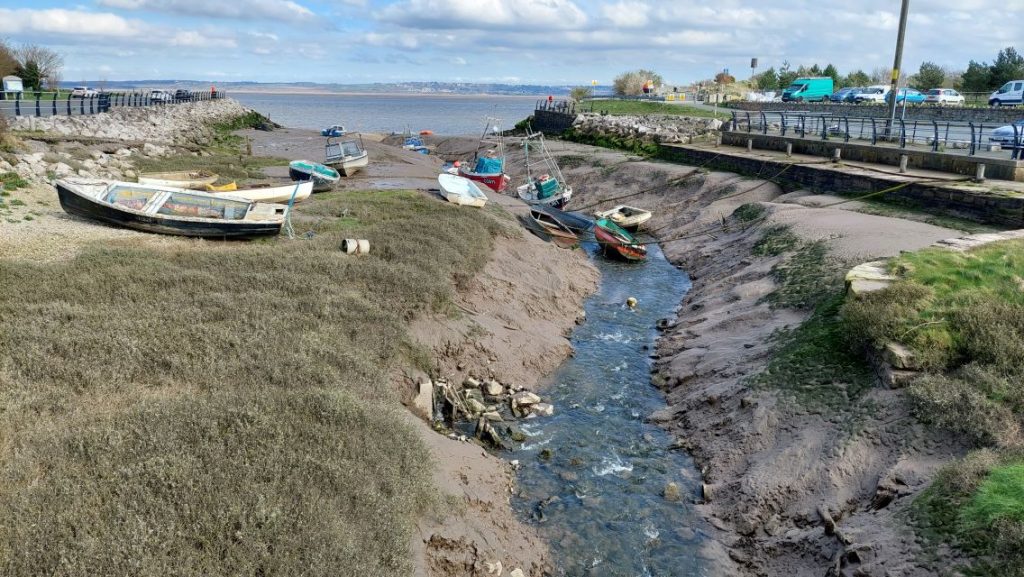
Along the coast path, through a place called The Marsh to reach the ruins of Basingwerk Abbey. We then go back along the Greenfield Heritage Trail, with many interesting features. We then go back to the town where Wetherspoons awaits.
The C Walk was led by Mike Martin & Bill Pearson.
This will be a circular route visiting St James’s Church, St Winifride’s Well (admission £2, or 65 and older £1), Basingwerk Abbey, and Greenfield. Halfway through the walk, we can offer an additional walk to Greenfield Dock as an optional extra – which would increase the length by a mile.
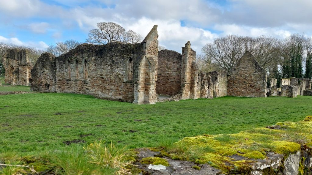
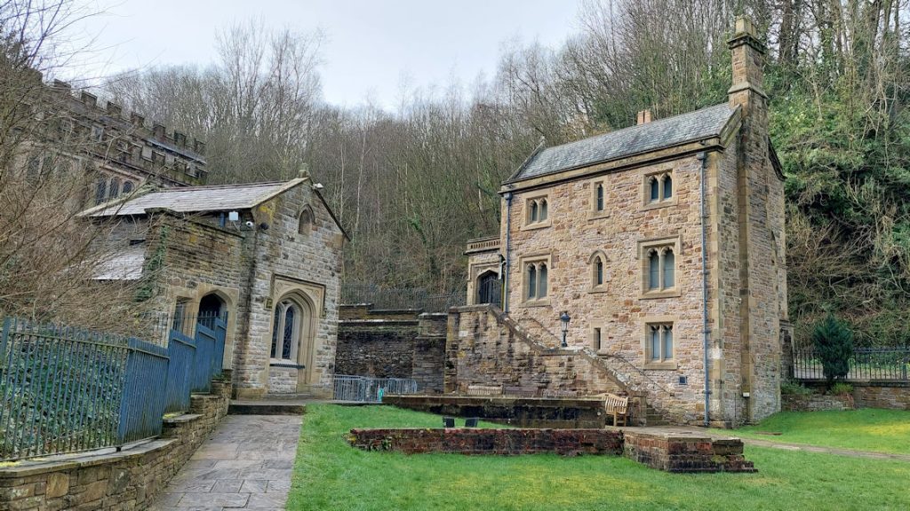
We will use the Greenfield Heritage Trail, the Pilgrim’s Way and the Wat’s Dyke Way. It’s a pleasant woodland walk with waterfalls, lakes and plenty of Industrial Archaeology. We will see The Battery Works, Meadow Mill Works and The Lower Cotton Mill.
The walk is predominantly very good paths (e.g. tarmacked old railway lines) and reasonably moderate slopes. There are a few steps, which can be avoided if preferred.
There are toilets at the start and end of the walk, and at St Winifride’s Well.
Hartington: Sunday 3 March 2024
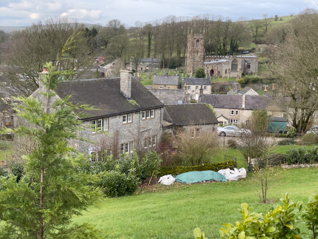
The A Walk (12 miles) was led by Phil Mellor.
Longitudinal walk starting at Hulme End where we have toilets and Cafe – further toilets at Wetton, Alstonefield & Hartington.
We start by walking along the Manifold Way before traversing up the side of the valley which gives us good views over the Dale. Now we walk up and over Wetton Hill before we drop down into the village and probably will use the seats on the green to have our lunch. We then use the quiet lanes to walk to Alstonefield as the path over the fields had lots of gates which slowed progress. Making our way to the river Dove we again have great views before dropping down the steep bank into Wolfscote Dale. Walking along the river we can admire the depth and the beauty of the valley then turning off Wolfscote Dale we enter Beresford Dale and then Hartington village.
The 9 mile B Walk was led by Ruth Beach.
We will be exploring the very attractive dales from Hartington along the River Dove. We start on one of the many trails from near the Youth hostel and then down in to Wolfscote Dale. We follow the river until we reach Coldeaton bridge, from here we have our biggest ascent of the day up what is called locally as Gypsy Bank. Lunch should be at Alstonfield, where there are lots of seats and public toilets. Then we descend round Narrowdale Hill back to the footbridge at the bottom of Beresford Dale. The route back from here will depend on how mud we fancy! But on the whole the dales are not too bad in the mud stakes as long as we miss Biggin Dale, which was very flooded.
The C Walk will be a moderate 6 miles, and will be led by Tony Whiffen.
The walk starts from the centre of this pretty Derbyshire village, and after a toilet stop we head out on a road track towards Bank Top Farm, when reaching the farm we climb briefly to start our walk on the grassy ridge. Here we have stunning views across the Dove valley and will have our first stop on some of the many rock areas to enjoy the views. We continue on the high ground for a further couple of miles until we reach Pilsbury Castle Eathworks where we will stop for our lunch.
This Motte and Bailey castle was built to control access along the Dove valley and probably dates from around the end of the 11th century. After lunch we head to the small Hamlet of Pilsbury (Note the amazing large old tree in the grounds of a farmhouse) before heading down to cross the river Dove. From here we follow a track up to the road and then make our way towards the village of Sheen, here we find the Church of St Luke’s which boasts a gravestone from the year 1200 (according to village history) from this point we take footpaths back to Hartington and these will be very boggy. Another mile and we will arrive back in Hartington.
Hartington is a very attractive stone village and has two pubs, a couple of Coffee shops, a country store and a famous old cheese shop that sells locally produced Stilton. All are open on Sunday’s (Cheese shop closes at 3pm).
The walk (mapped at 5.87 miles) has stunning view and very gradual ascents. Conditions on the recce were very wet and boggy under foot so gaiters would be a help and a spare pair of socks.
Willaston on the Wirral: Sunday 18 February

The A walk joined the B walk.
The B Walk will be 9.5 miles, and will be led by Bryan Roe. It’s mostly undulating flat ground (gaiters recommended).
The walk starts in Willaston- a former Railway Station. We head out of the Village joining the Wirral Way. a former Railway Line closed by Earnest Marples (MP for Wallasey) following the Beeching Report.
We follow the former Line until we reach the former Station at Hooton.
We then branch off right towards a small housing estate, cross the M53 Motorway into another housing estate towards the Village of Eastham.
Passing through Eastham, we eventually arrive at the site of the former Eastham Ferry terminal ( on the River Mersey) and close to the locks system entrance to the Manchester Ship Canal.
Good views of the Liverpool and the widest part of the River can be seen here.
We then head west inland through Bromborough and cross the Motorway towards Raby Nurseries and head southwest.
The final stretch of the walk is mainly south back to Willaston.
The C Walk will be about 6 miles, and will be led by John Chambers. It will be flat, with negligible ascent. It will use reclaimed railway track, tree lined bridleways and quiet lanes and roads – with minimal mud.
This easy walk (No Stiles) is circular starting and finishing at Pollards Inn located in the centre of Willaston Village. It is largely a flat walk, starting on the Wirral Way following a section of the reclaimed railway line. It passes Hadlow Road Railway Station Museum which is a 1950’s restored station to include a platform, waiting room, ticket office, and signal box as a reminder of the original railway station, and includes a characterful indoor and lively outdoor platform cafe. We then join short sections of quiet country lanes and roads passing throughout many horse training paddocks and Spring like sheep enclosures. (Horse spotters will not be disappointed – Don’t forget the peppermints). Returning en route we pass by the Willaston Mill, the highest brickwork structure on the Wirral built in the year 1800. Currently the mill is undergoing restoration having had the brickwork repointed and awaits a replacement roof structure. The building is shrouded in scaffolding.
We return on paved roads and paths to Willaston and Pollards Inn.
Whaley Bridge: Sunday 4 February 2024
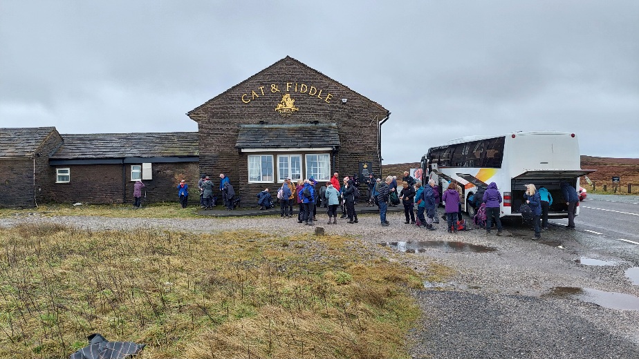
The A and B walkers got off at the Cat and Fiddle, and did a linear walk to Whaley Bridge, where the C walkers did a shorter circular walk around Whaley Bridge. More pictures are in our Gallery Page.
The A Walk will be a moderate 12 miles, and will be led by Phil Mellor.
We start our walk at the Cat and Fiddle pub on the Macclesfield to Buxton road which is one of the highest pubs in England and is some times closed due to snow drifts. Walking over the moor we have our first brief stop to admire the views over the Cheshire Plain at Shining Tor (559 meters). Now we make our way down to Lamaload Reservoir where we will have a morning break overlooking the water which is a haven for bird watching. Walking along Hooleyhey Lane we reach Nab End where in 1735 John Tur lost his life in a snow storm but a puzzle remains today as just one lady’s foot print was found by his body the next day. Continuing we reach the Jenkin Chapel before we walk up the lane to Pym Chair and then down towards Errwood Reservoir before we turn off to have lunch along the side of Fernilee Reservoir At the end of the reservoir we walk along the Goyt Valley before joining the Midshire Way which again gives us great views over the Valley. We continue to the village of Takal before walking down into Whaley Bridge where we will find our coach and the facilities of the town.
The B Walk will be an easy 8 miles and will be led by Mike Leydon.
Today we have an easy (mostly flat or downhill) 8 miles linear walk along the picturesque Goyt Valley. We start our walk up on the moors by the Cat and Fiddle pub, and head down into the Goyt Valley. Our route takes us through woodland alongside firstly Errwood reservoir and then Fernilee reservoir. We then walk along farm tracks and open fields as we head towards Horwich End. Here we encounter Toddbrook reservoir. In 2019 the dam started to fail threatening the town with flooding. The final steps of the walk take us through a park leading on to the main street in Whaley Bridge where toilets and refreshments can be found.
The 6 mile C Walk was led by Bryan Clydesdale.
The walk starts in Whaley Bridge close to the railway station where there are toilets. We leave Whaley Bridge passing through some local housing and a new development.
Then we walk around the Toddbrook Reservoir dam which is being refurbished and onto Taxal village passing the church. Following the Midshires Way we have a long gradual climb up to Overhall Farm with extensive views over the High Peak area. Continuing onwards we drop down into Mill Clough and then climb out again passing Madscar Farm. We continue onto the Fernilee Reservoir. This is the southernmost point of our walk and we are now returning homewards following the River Goyt. We continue alongside the river passing through Shallcross Wood till we reach Horwich End. Here we leave the River Goyt and head back into Whaley Bridge through the Linear Park.
Bollington: Sunday 21st January 2024
The 12 mile A Walk was led by Phil Mellor.
We start by walking on the Middlewood Way before joining the North Cheshire Way. Now we have some lane walking before we enter Lyme park estate by using the picturesque valley to the mill pond and manor house. On leaving the estate we join the Gritstone Trail which takes us up to the Bow Stones and then to Sponds Hill (410 meters) with great views as we cross the moors. Dropping down we continue the Gritstone to walk under White Nancy (In the event of poor weather we can omit this portion of the Gritstone to walk directly into the town). Dropping down into the town and crossing the town park we again find the coach for our return.
John Moreton led the easier 9 mile B Walk.
It’s a fairly easy walk with one steady climb. We set off along the Middlewood Way, following the former Macclesfield, Bollington and Marple railway, before joining the canal towards Poynton, across fields climbing up towards Park Moor and Sponds Hill. From here we have good views that include Manchester Airport. We return towards Bollington partly on the Gritstone Trail, giving us views of White Nancy, before reaching the road into town and back to the Dog & Partridge pub.
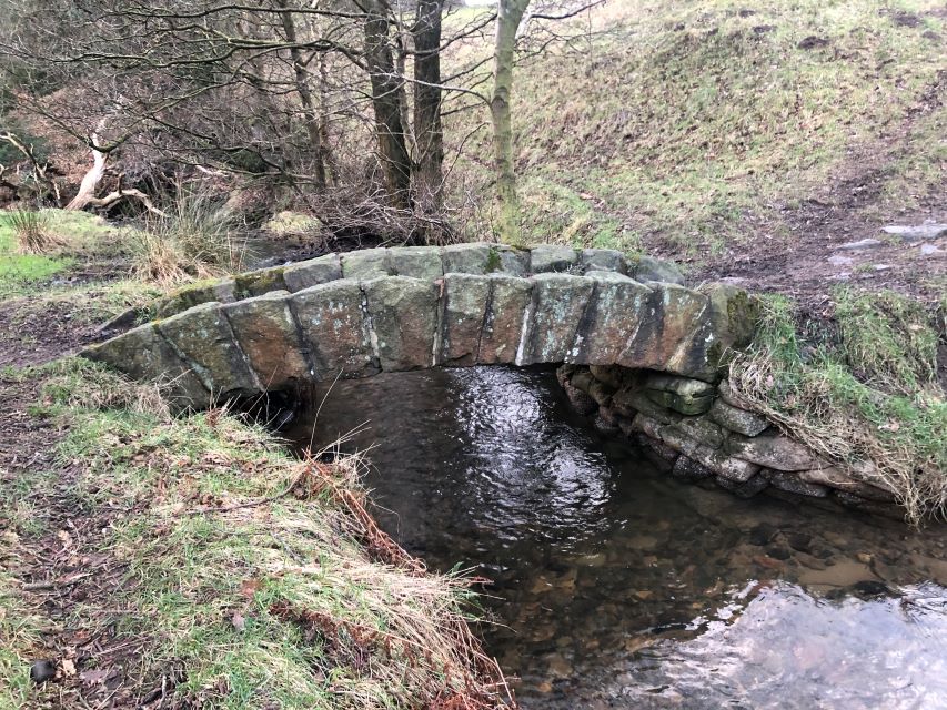
The C Walk will be approximately 6 miles, and will be led by Mike Martin. It starts out reasonably level before a gradual uphill section. Once this has been done it is mainly downhill or level.
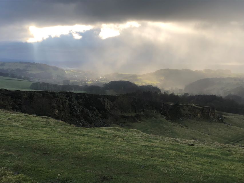
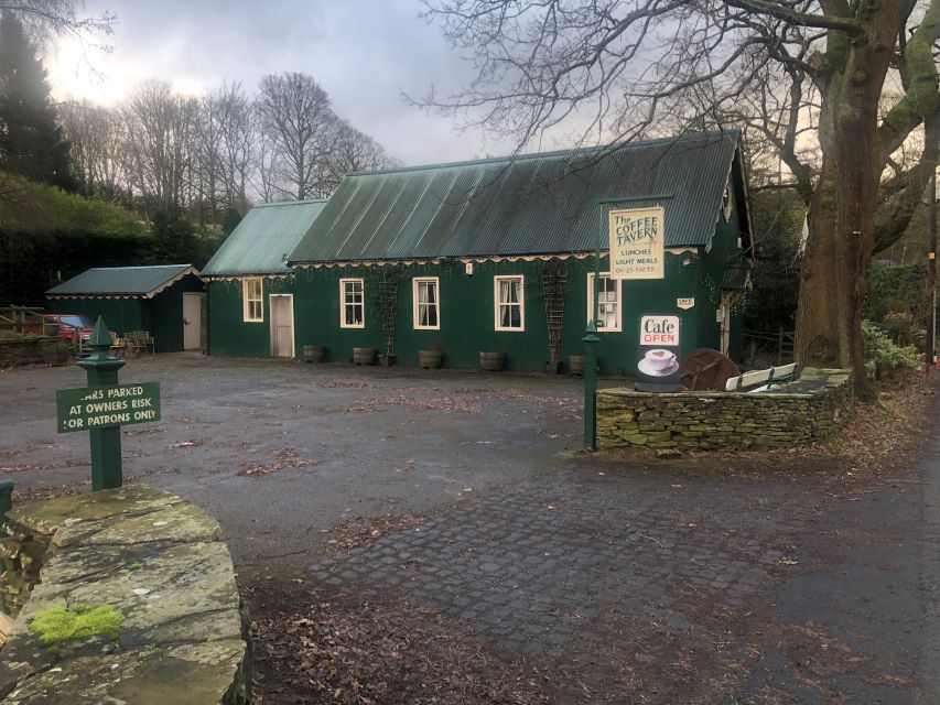
Marple Bridge: Sunday 7 January 2023
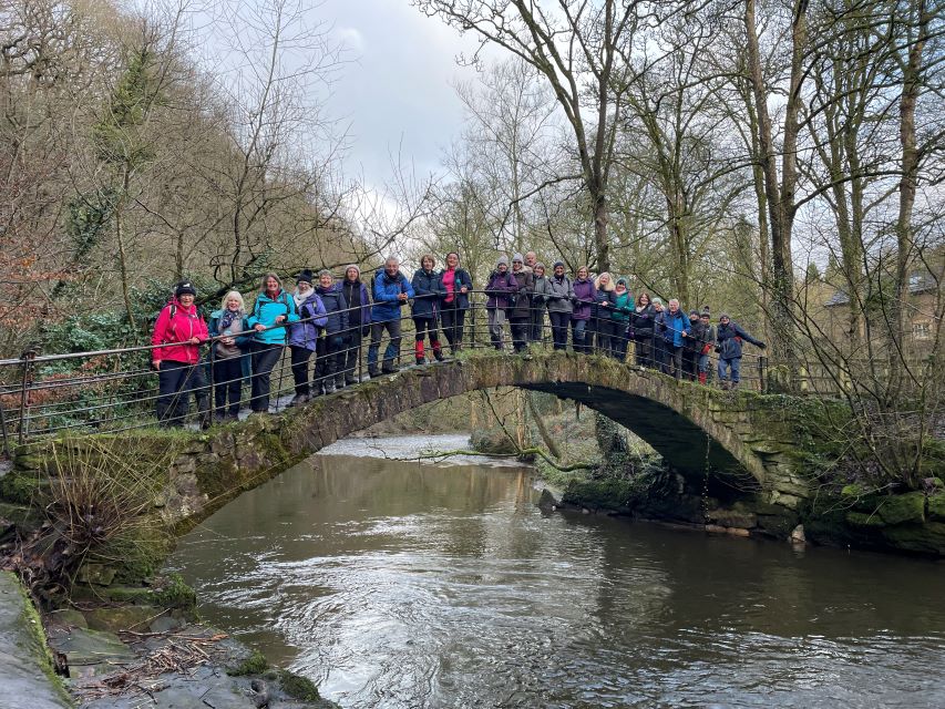
The A Walk will be a moderate 12 miles, and will be led by Yvonne Mason. We start our walk from the town by walking up the road and out into the country to the small village of Mill Brow. From the village we climb to Mellor Church where we will have our first break at the Iron Age dwelling which has a replica of a round house. Also at the church we can see the archaeology of the Roman / Iron Age excavations. Passing through the village of Mellor we make our way to get good views at the top of Mellor Moor. At the Trig Point [327 meters high] we will be able to see the circle of the Neolithic and Bronze Age Burial Site where valuable items have been discovered. Now we see the large Wooden Cross which looks down on the Goyt Valley before making our way across a Golf Course and down to the town of New Mills. In the town we visit the historic Torrs, Archimedean Screw Hydro scheme and the Millennium walk which is suspended above the river. Now we are on our way back following the Goyt Way passing Brook Bottom, Roman pack horse bridge, Roman Lakes and Oldknow’s Mellor Mill site before we return to Marple Bridge.
The B Walk will be 8 miles, and will be led by Ruth Beach. We will be starting from the car park near the station. Unfortunately, there is no toilets, but there is some cover amongst the brambles! We could easily make a slight detour into Etherow country park to use the toilets there. The walk has a few steepish ups and down and of course there will be some muddy stretches.
We set off along the River Goyt through Brabyns Park. We then head up toward Mill Brow and then along my favourite path in Mellor at Hollywood End. Then it is up to Mellor Hall and the Church, which would be ideal for lunch. From the Church we descend down to cross Longhurst Lane, then to the Scout Camp at Linnets Clough and across Mellor Golf Course to reach the ‘Roman bridge’ which we cross. Then it is up to the canal, which we follow nearly all the way back to the coach.
My plan is to stop and have a drink at the Navigation pub which is next to the canal, this would save having to go down and up to Marple Bridge to get a drink. If you do not want to stop you would be welcome to go back to the coach.
The C Walk will be a moderate 6 miles, and will be led by Tony Whiffen. From the coach park in Marple Bridge we pick-up the Midshires Way and continue through open pathway, crossing the river before heading up to meet the B6104. Here we cross the road and continue on the path until the start of Compstall Lake and Etherow Country Park, there are toilets available here next to a café. From here we follow the route through the woodland areas where we will have our first stop overlooking the river and lake in a seated area. We continue in Etherow Country Park and on too Compstall Nature reserve, this follows through wooded area with plenty of seats available for breaks. Hopefully we will stop for lunch in an open sheltered and seated wooden hut if vacant. Once off the tarmacked track we walk through Compstall Nature reserve returning around another lake bordering the river. Eventually we meet up with the outbound track and return to Compstall on the opposite side of the lake, again there will be a toilet opportunity at the café before returning to the Marple Bridge on the Midshires Way.
There are NO styles on this walk and much of it is on tarmacked ways with moderate inclines, the lakes are full of ducks, geese and swans, including the colourful Mandarin duck.

